This spring I had the opportunity to pilot the new online GeoCode tephra activities developed as part of the NSF-funded Visualizing GeoHazards and Risk with Code project with my 9th grade Honors Earth Science classes in Evergreen, Colorado. I’d been looking forward to the pilot for months, but only a handful of weeks before our planned lessons, the world went on lockdown and my public school science classroom went online virtually overnight. Instead of planning for the GeoCode pilot, I found myself scrambling to figure out how to teach Earth science remotely.
My fellow Earth Science teachers and I agreed to go ahead with the pilot. Not only was it our only choice for trying out the module with students, but we also felt that remote learning could potentially play an important role in our educational landscape for the foreseeable future. With that in mind, we opted to let the students run the activities remotely and check in with them online. I’m glad that we did.
As science teachers, my colleagues and I have invested a lot of time in the past few years working on understanding the Next Generation Science Standards and bringing our courses in line with them. We’re devoted to three-dimensional teaching–integrating disciplinary core ideas with science practices and crosscutting concepts. As what we thought was going to be an extended spring break ballooned into a global pandemic that would shutter school buildings for the rest of the year, I was at a loss to figure out how to keep my three-dimensional science class from devolving into something very one-dimensional. Looking over the GeoCode volcanic hazards module, I realized that the activities would guide my students through several scientific practices and crosscutting concepts while also being grounded in Earth science content.
The “Assessing Volcanic Hazards and Risk with Code” Module
This GeoCode module is a series of six activities that can be completed fully online. Students explore the Cerro Negro volcano in Nicaragua and the potential risk it poses to nearby towns and agriculture. Students write their own computer code to model variables that influence volcanic ash distribution and query local wind data collected over a period of 11 years at Cerro Negro. The database contains 16,000 measurements for wind speed and wind direction.
As students work their way through the activities, they learn about the types of hazards posed by volcanoes and are asked to focus on tephra (specifically ash) as a hazard at Cerro Negro. They begin with some basic block coding to create tephra visualizations (Figure 1) on a map to see how wind direction, wind speed, column height, volume of ash, and the volcanic explosivity index determine where the tephra would spread and how thick the tephra would be at different locations. Students also learn about the uncertainty of forecasting weather conditions and tephra volume for an unknown future eruption (Figure 2).
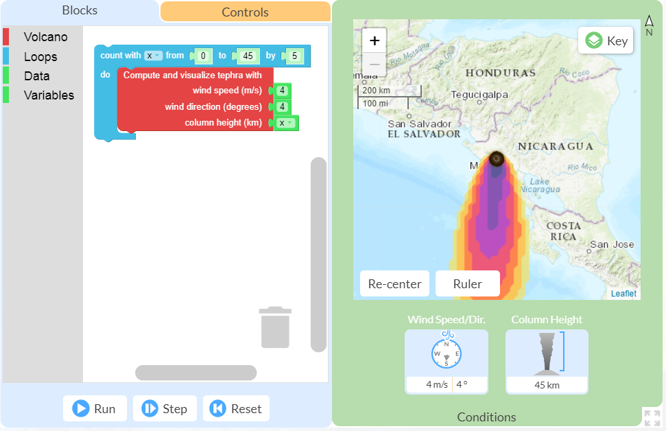
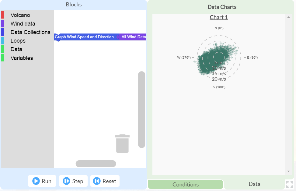
Ultimately, students are asked to apply what they’ve learned about writing code that samples a database to the task of assessing risk at different places on the map. The last activity introduces them to a Monte Carlo simulation in which they write code to run the tephra model hundreds of times with randomly sampled eruption and weather parameters in order to determine the likelihood of impacts to a town near the volcano.
Pilot Implementation
Since my school district had opted for only asynchronous online learning during the COVID-19 crisis, I couldn’t require students to be online live with me at any time. Furthermore, my district had opted for four-day school weeks and my school schedule necessitated that only half of the classes “met” each day. This meant that I was expected to post in Google Classroom for my Honors Earth Science sections on Tuesdays and Thursdays each week. Under these circumstances, I thought it best to post everything at the beginning of the week and allow my students to pace themselves through the activities. Figure 3 shows a screenshot from my Google Classroom Stream on the first day of the GeoCode pilot.
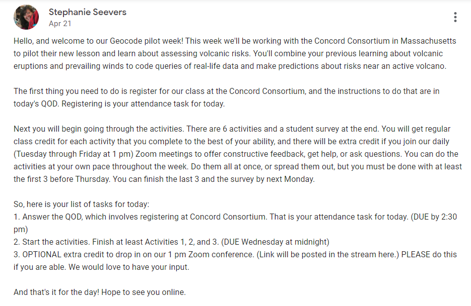
If we had been in the classroom, I would have done a bit of work heading into the pilot to prepare students for the week and review some of our previous learning about volcanoes. As it was, I felt that I had to be a lot more focused. I already had to cut out quite a lot of curriculum to accommodate our online learning structure, and I didn’t want to cause any unnecessary stress or confusion for my students, so I kept my Google Classroom posts to a minimum, and students dove into the GeoCode module without any prior preparation.
What went well?
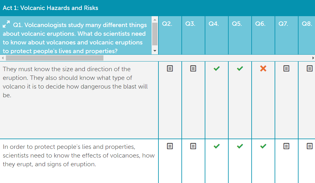
The GeoCode activities are well-scaffolded, and my students were able to follow them at home on their own with very little help from me. Using the GeoCode Teacher Dashboard, which supports teachers’ implementation, I could monitor students’ progress through the module. Figure 4 shows a screenshot of my Dashboard (with the students’ names cropped off the left side for their privacy, of course). The gray bars show their overall progress on each activity, and I could easily see at a glance which activities they had completed. It’s easy to see on the fourth entry down, for example, that a student had skipped Activity 5 and moved on to finish Activity 6 out of order.
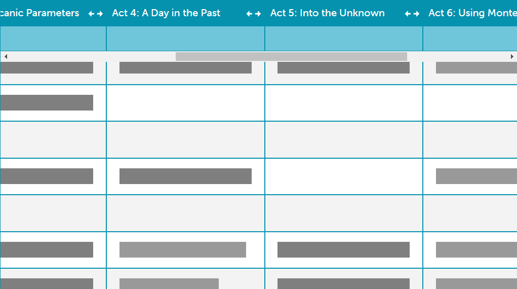
The Dashboard also allowed me to drill down to more detail within each activity (Figure 5). I could expand individual activities to see the embedded questions and further expand each question to read students’ answers and even provide individual feedback. Throughout the week, students’ answers to the questions showed me what they were understanding and what they were struggling with.
We hosted daily Zoom meetings for students to drop in and give feedback or ask questions, and we mostly heard from students that they were succeeding. The bulk of the questions were related to small technical glitches that have since been ironed out. Students reported a high level of interest and engagement, and overall they enjoyed the module and felt that they learned from it.
The most positive feedback was how much the students enjoyed the coding. They were energized by the chance to interact with the data, and it gave them more agency with their learning. Computational skills are invaluable in all fields of the earth sciences, but it’s very difficult to find ways for 9th graders to get a chance to do any coding at their level that is directly applicable to the science they’re learning. GeoCode is unique in this way.
What would I change?
But, as I noted earlier, my school district had opted for only asynchronous online learning during the COVID-19 crisis, so I couldn’t require students to attend our daily Zoom meetings. As it turned out, only a small percentage of students dropped in on them, so I wound up feeling disconnected from my students and their learning. GeoCode records student answers to the questions in the Dashboard, but since I allowed students to pace themselves, I couldn’t realistically offer timely feedback before they went on with the activities. If I were to do this again online, I think I would pace the activities and require some online discussion between them.
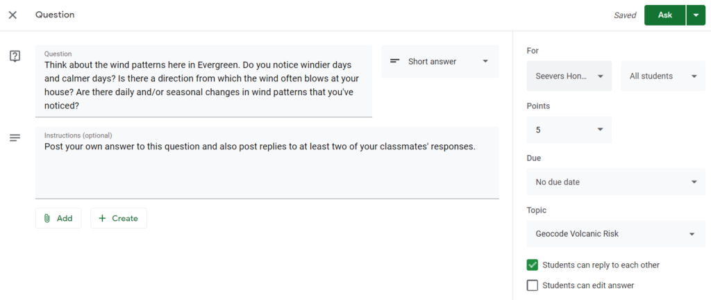
Since the prospects for in-person learning are still uncertain for next school year, I am currently planning for the possibility of another online implementation of this GeoCode module. Without the option of synchronous video meetings, I’d opt for a discussion thread in Google Classroom. In my brief and frenzied experience with fully remote learning last spring, I never tried to structure online discussion threads in Google Classroom, so it will be an experiment. Posing questions in the Classwork tab and selecting the “Students can reply to each other” option might be the best approach. Figure 6 shows a screenshot of a potential question that I could post before students begin Activity 2.
I would also try to capitalize on the opportunity to follow up on the learning in the module, by diving more deeply into the concept of risk assessment. Students could discuss its application to other areas of Earth science, such as earthquakes, severe weather, and climate change hazards.
Overall, implementing the GeoCode tephra module was a bright spot amidst a crazy few months of hastily implemented remote learning. The module is going into my permanent Earth science curriculum–for my remote or in person classroom.
One thought on “Piloting the “Assessing Volcanic Hazards and Risk with Code” Module during COVID-19”
Comments are closed.
This is such a helpful synopsis of the activity. The feedback on how to make this work in an online environment will be very helpful this coming year when I attempt it with my 9th graders.
I am impressed that you and your co-teachers decided to go ahead with this during quarantine!