Category: GeoCode
Every education project funded by the National Science Foundation (NSF) is subject to flexible yet high expectations for the proposed research. NSF is investing in our ability to develop new technology, new curriculum, and new research that contributes innovative ideas and products to further the field of STEM education. When we are awarded an NSF […]
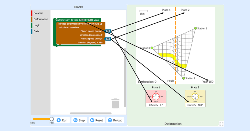
The everyday work of modern seismologists—the scientists who study earthquakes, hazards, and risks—exists right at the intersection of two NGSS practices: “Analyzing and Interpreting Data” and “Using Mathematics and Computational Thinking.” Seismologists collect huge amounts of data from satellites, remote sensors, and GPS networks in order to monitor Earth’s surface for signs of land movement […]
We are excited to announce that our GeoCode: Volcanic Hazards module is available for public use! This free two-week curriculum for middle and high school students has been piloted by participating research teachers as part of the National Science-Foundation funded GeoCode project and extensively studied and redesigned based on our research. It is now available […]
We recently revised our mission and vision statements, and described our efforts to address issues of diversity, equity, inclusion, and justice in several of our research projects. We know that this was only a beginning. As we said, “We are still learning how to design science, technology, engineering, and mathematics resources that are more socially […]
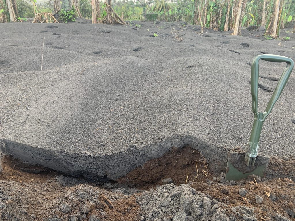
Robert Constantinescu, a Ph.D. candidate in volcanology at the University of South Florida (USF), flew to the island of St. Vincent after the explosive activity at the La Soufrière volcano subsided. Between May 1 and 13, 2021, he worked alongside local scientists from the Seismic Research Centre of the University of West Indies to collect […]
This spring I had the opportunity to pilot the new online GeoCode tephra activities developed as part of the NSF-funded Visualizing GeoHazards and Risk with Code project with my 9th grade Honors Earth Science classes in Evergreen, Colorado. I’d been looking forward to the pilot for months, but only a handful of weeks before our […]
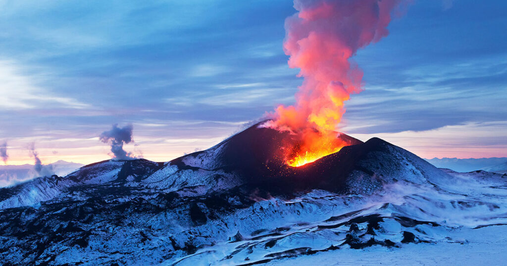
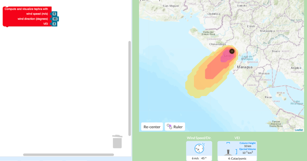
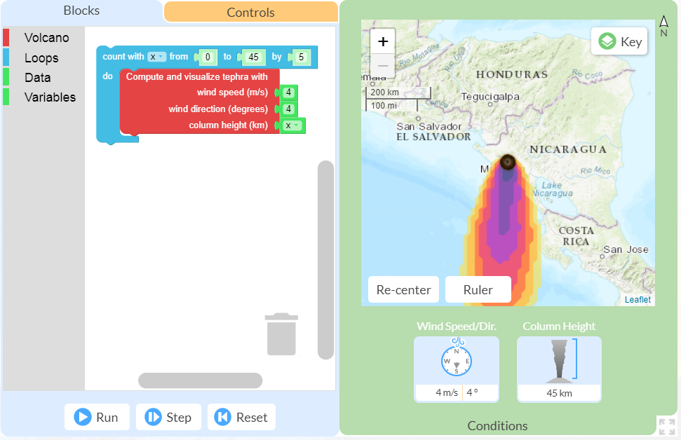
All volcanic eruptions are dangerous. Some are more dangerous than others. Volcanic eruptions range from slow, relatively gentle flows of lava to explosive eruptions of gases, ash, and rock. Our Visualizing Geohazards and Risk with Code project (GeoCode) challenges students to model tephra volcanic eruptions (tephra refers to all particles ejected explosively from a volcano, […]
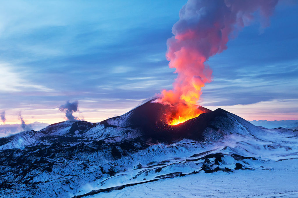
Volcanoes are some of the most impressive and unstoppable features on Earth. From the amazing artifacts at Pompeii to the photos of forests flattened by lava flows, the dangers associated with volcanoes are both terrifying and awe-inspiring. However, despite the risks, millions of people live in constant threat of damage to their homes, and more […]