Category: Tag: GeoCode
Shelley Olds is an Instructional Designer at the EarthScope Consortium. Many middle and high school students learn about earthquakes by studying California since it is the most seismically active state in the contiguous United States. Students learn that there is an earthquake cycle and that the cycle that ends with an earthquake. But what happens […]
Symbols, objects, maps, graphs, and simulations are all powerful tools for conveying information. However, some complex ideas just can’t be captured in a single representation. In these cases, multiple visualizations can be used together to convey and connect several pieces of related information. For example, during the COVID-19 pandemic, news organizations used a combination of […]
By any measure, this has been one of the most stressful years on record, and teachers are among those most affected by the massive devastation wreaked by COVID-19. A recent New York Times article describes the emotional and physical toll of pandemic teaching, and we’ve heard directly from many teachers with whom we’ve collaborated for […]
TecRocks allows students to investigate the evolution of rock sequences created under different tectonic conditions.
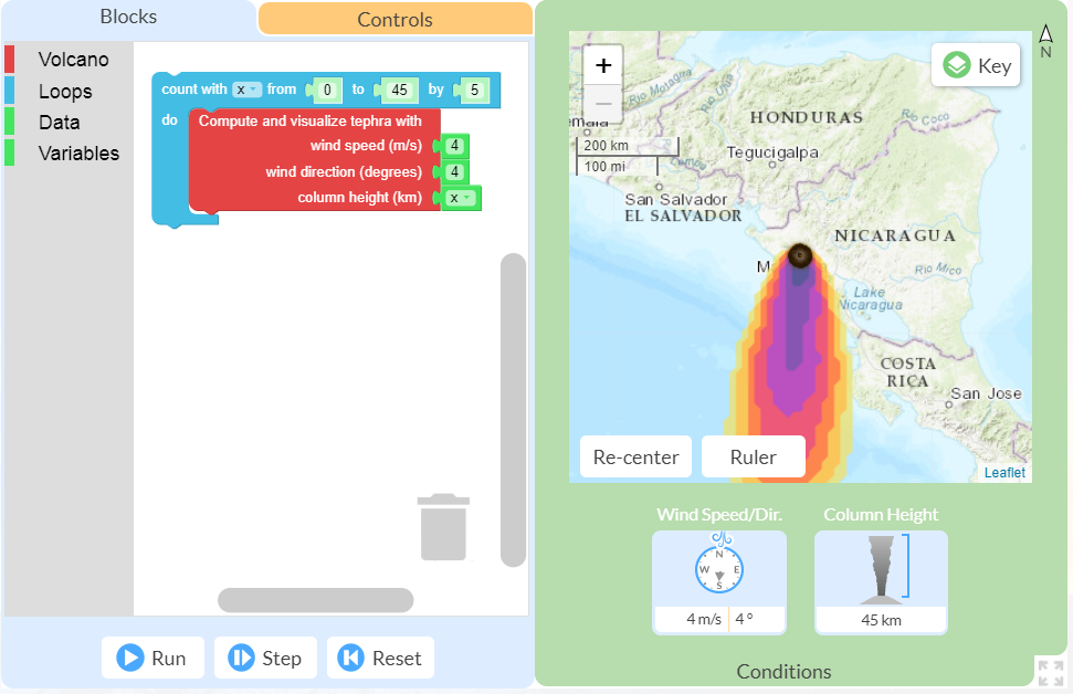
This spring I had the opportunity to pilot the new online GeoCode tephra activities developed as part of the NSF-funded Visualizing GeoHazards and Risk with Code project with my 9th grade Honors Earth Science classes in Evergreen, Colorado. I’d been looking forward to the pilot for months, but only a handful of weeks before our […]
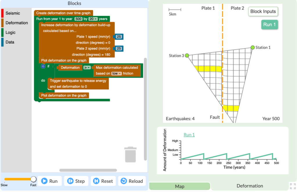
All volcanic eruptions are dangerous. Some are more dangerous than others. Volcanic eruptions range from slow, relatively gentle flows of lava to explosive eruptions of gases, ash, and rock. Our Visualizing Geohazards and Risk with Code project (GeoCode) challenges students to model tephra volcanic eruptions (tephra refers to all particles ejected explosively from a volcano, […]
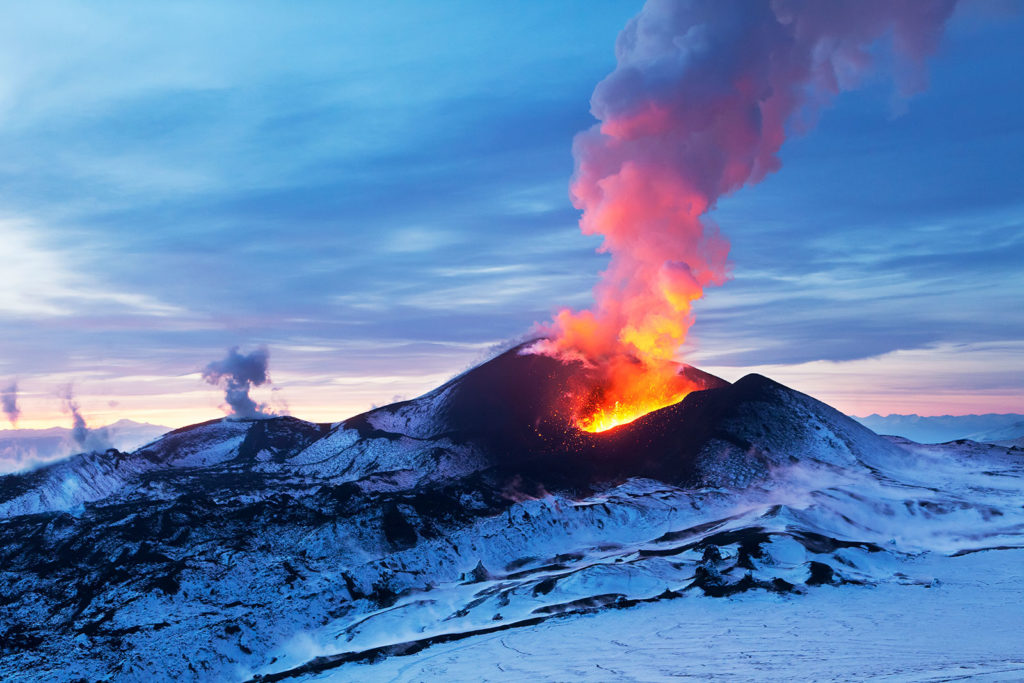
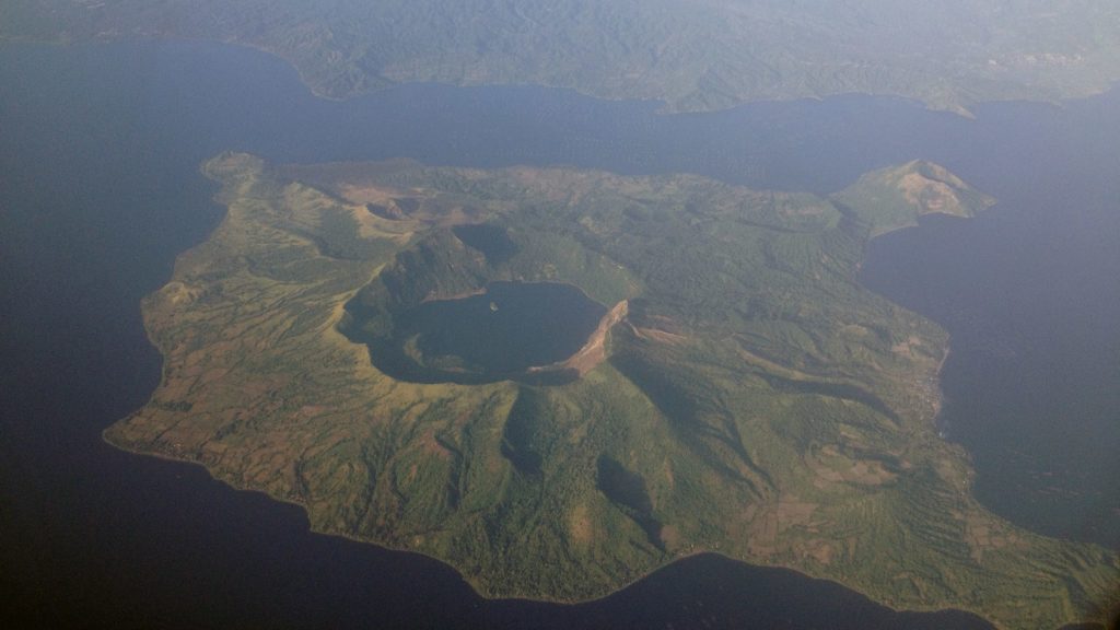
Volcanoes are some of the most impressive and unstoppable features on Earth. From the amazing artifacts at Pompeii to the photos of forests flattened by lava flows, the dangers associated with volcanoes are both terrifying and awe-inspiring. However, despite the risks, millions of people live in constant threat of damage to their homes, and more […]

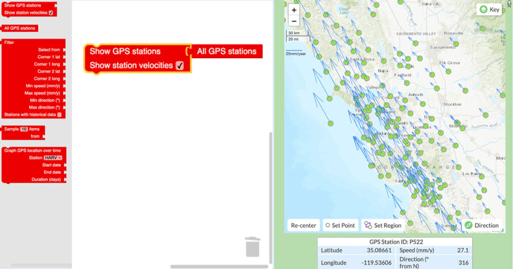
Engaging students in the study of geohazards through integrating computational thinking with science practices. Students will be able to transform real-world GPS data into visualizations and formulate scientific arguments about predicting impacts and assessing risks.