Category: Earth Science Education
The Concord Consortium is proud to announce a new grant from the National Science Foundation for our Intelligent Simulation-based Learning About Natural Disasters (ISLAND) project. ISLAND will harness the power of artificial intelligence to help middle school students explore wildfires, floods, and hurricanes through scientific simulations—building critical knowledge and science practices for understanding and responding […]
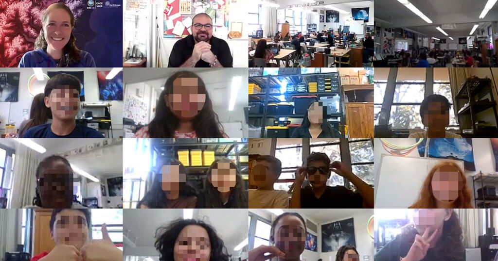
Shelley Olds is an instructional designer at EarthScope Consortium and a partner on the YouthQuake project. Generating thoughtful questions—and building the confidence to ask them—is a cornerstone of scientific inquiry. Middle school students in the YouthQuake project had the rare opportunity to ask geoscience professionals about their journeys into STEM careers and explore their own […]
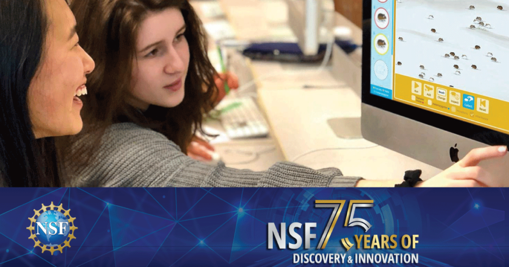
On May 10, 2025, the National Science Foundation (NSF) celebrates 75 years of empowering discovery, innovation, and learning. For generations, NSF has supported the ideas and people that have shaped STEM education, research, and opportunity in America. But this milestone is more than a celebration—it’s also a moment for reflection. The gains we’ve made through […]
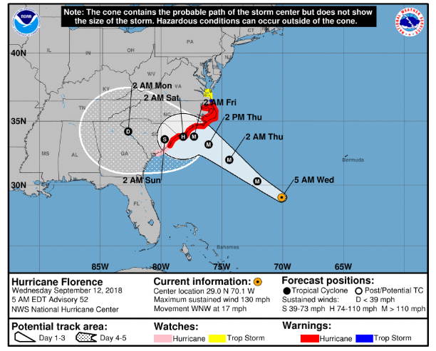
At the Concord Consortium, we believe that science education should reflect the dynamic, uncertain, and inquiry-driven nature of science itself. In our recently published study in the International Journal of Science Education, we explore how middle and high school students engage in hurricane science by interacting with the very tools scientists use to reason about […]
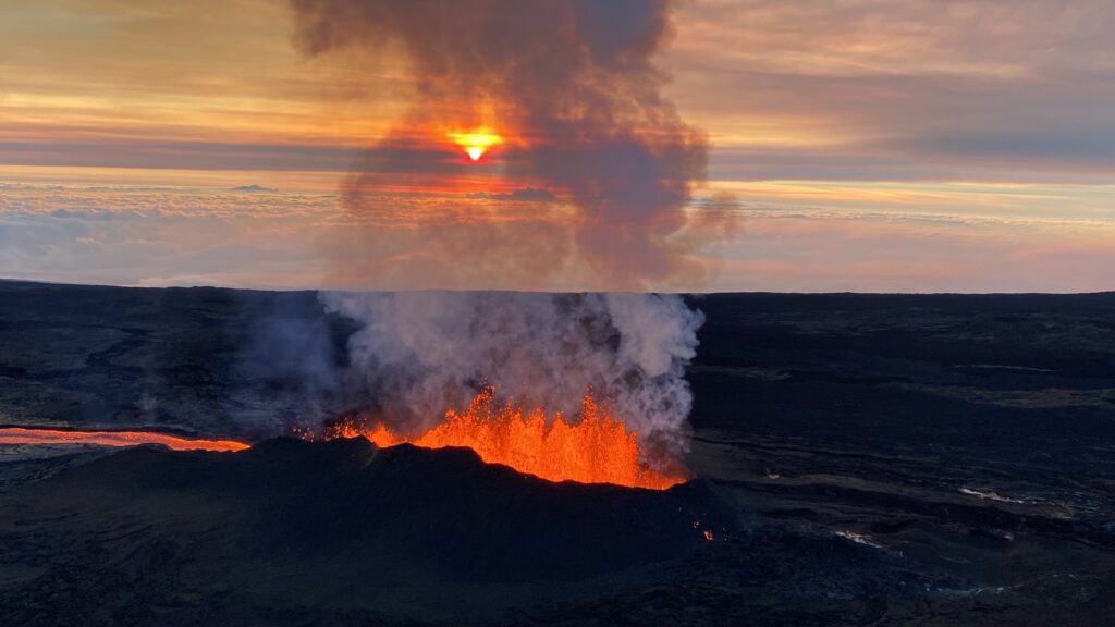
Hawaiʻi’s iconic volcanoes have shaped its islands, culture, and communities for centuries. From the breathtaking eruptions of Mauna Loa to the challenges of living with air pollution caused by the eruptions (known as “vog”), volcanic activity is an intrinsic part of life in Hawaiʻi. What if students could harness computational tools to better understand volcanic […]
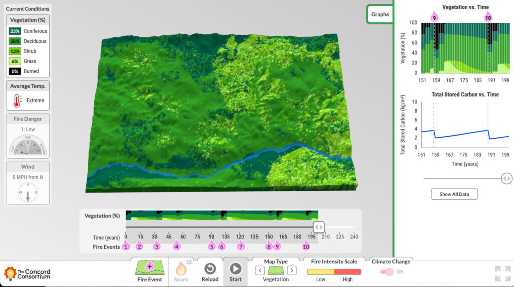
Massive amounts of Earth’s stored carbon is located in boreal forests, including those in northern Canada and Alaska. As temperatures rise and wildfires become more frequent, scientists are studying the boreal forest’s transformation from carbon sink to carbon source. We partnered with Dr. Brian Buma at the University of Colorado Denver and the Environmental Defense […]
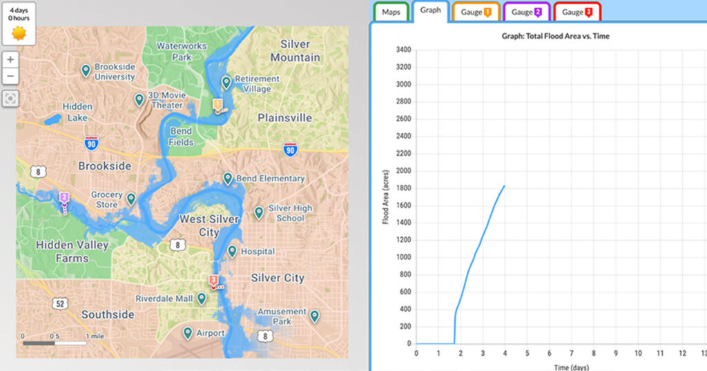
Stephanie Harmon is a Science Consultant with the Partnership Institute for Math and Science Education Reform (PIMSER) in Kentucky. Previously, she taught Earth science and physics at Rockcastle County High School in Mount Vernon, Kentucky, and has consulted on several Concord Consortium projects. For my students in rural Kentucky, floods are personal. In July 2022, […]
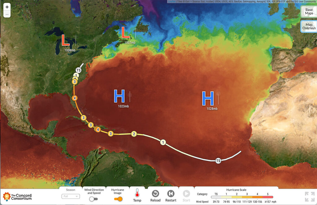
Michael Focht is a middle school teacher in Titusville, Florida, and field tested our GeoHazard modules. Do the names Matthew, Nicole, Ian, or Irma give you pause? Are they long-lost cousins? Friends from high school? For the students in my middle school science classes, these are the names of hurricanes that have impacted them over […]
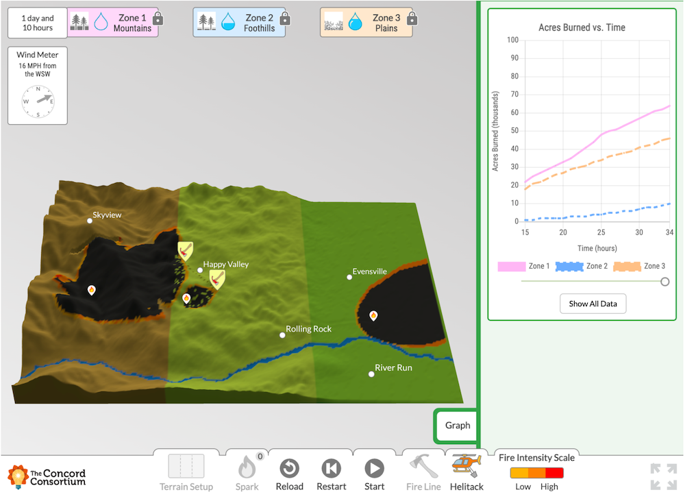
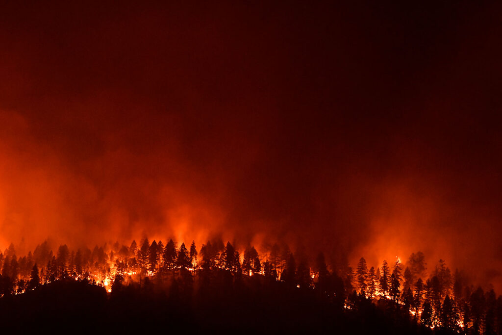
Turn on the news and you’ll see horrific images of flames enveloping hillsides, engulfing homes, and destroying entire communities. This year’s wildfire season is on track, once again, to be one of the worst in history. The number of acres burned in California in August 2024 is already more than double the number of acres […]
The WATERS (Watershed Awareness using Technology and Environmental Research for Sustainability) project recently ended with a Master Teacher Workshop at our Concord office for selected teachers who participated in the National Science Foundation (NSF)-funded research with excellence and enthusiasm. The goal of the workshop was to exchange best practices for teaching the now freely available, […]