Robert Constantinescu, a Ph.D. candidate in volcanology at the University of South Florida (USF), flew to the island of St. Vincent after the explosive activity at the La Soufrière volcano subsided. Between May 1 and 13, 2021, he worked alongside local scientists from the Seismic Research Centre of the University of West Indies to collect tephra fall samples, map the deposits, and document the damages from the eruption. Following the massive eruptions, it was important to collect data quickly.
Robert is an active contributor to our GeoCode: Visualizing Geohazards and Risk with Code project. The data that he’s collected in the field allows him to apply a new tephra model developed by a team of volcanologists at USF, including Robert, to these deposits in order to estimate the magnitude and intensity of this eruption.
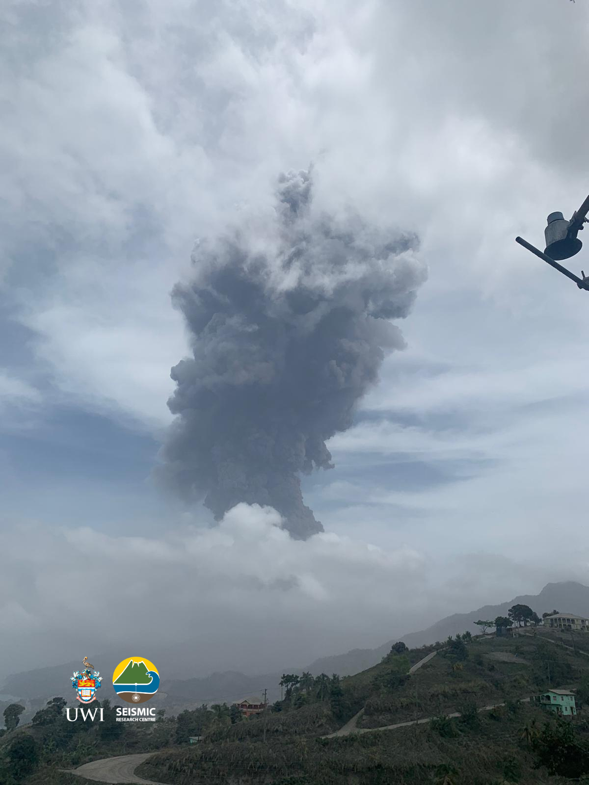
Eruption of La Soufrière volcano on April 14, 2021. (Photo credit: T. Christopher, MVO)
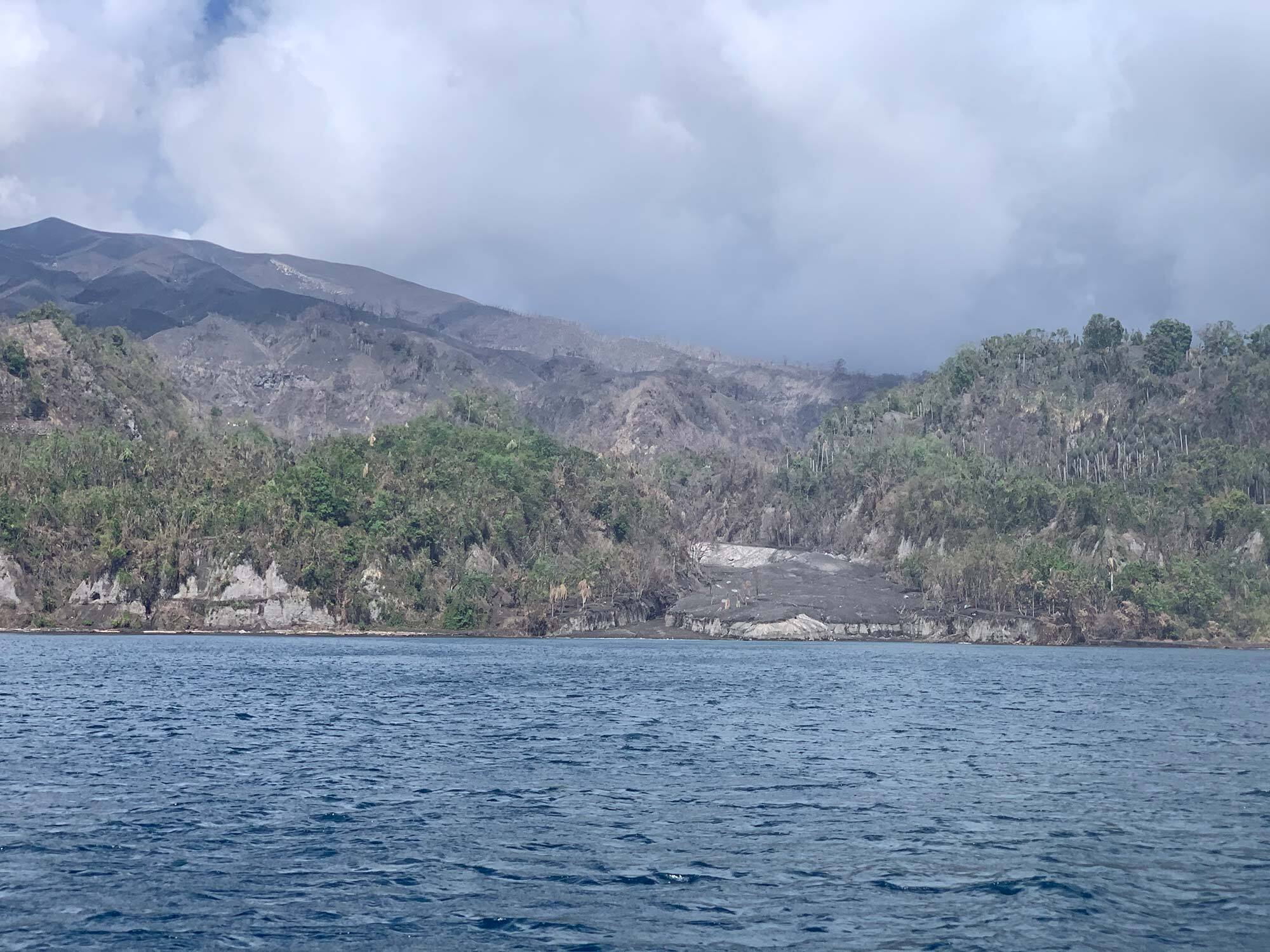
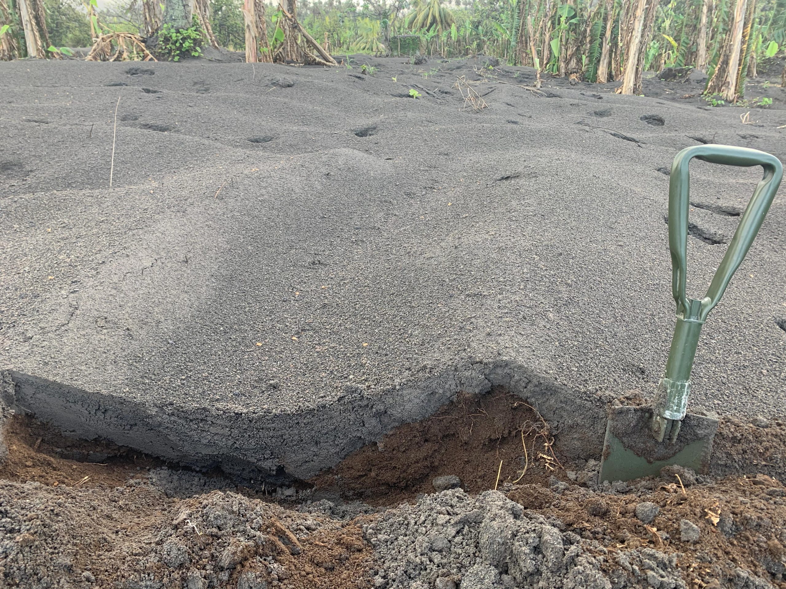
Tephra blanketing the landscape. (Photo credit: R. Constantinescu, USF)
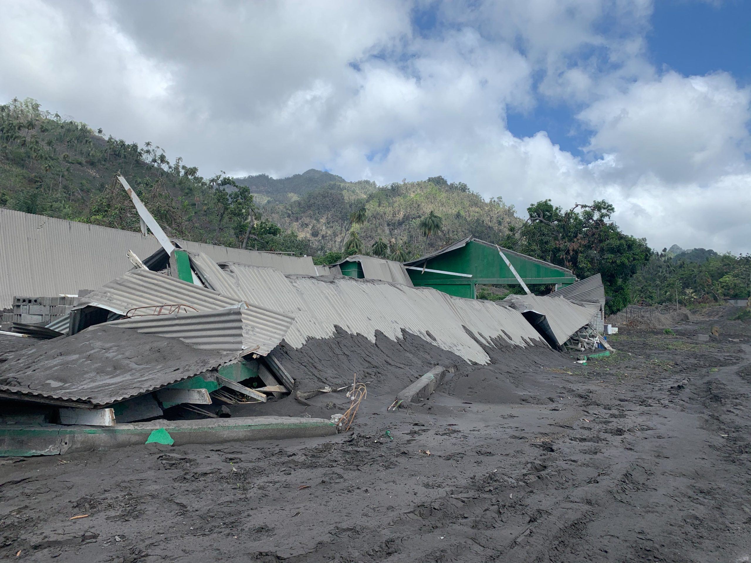
Building damaged by tephra deposits. (Photo credit: R. Constantinescu, USF)
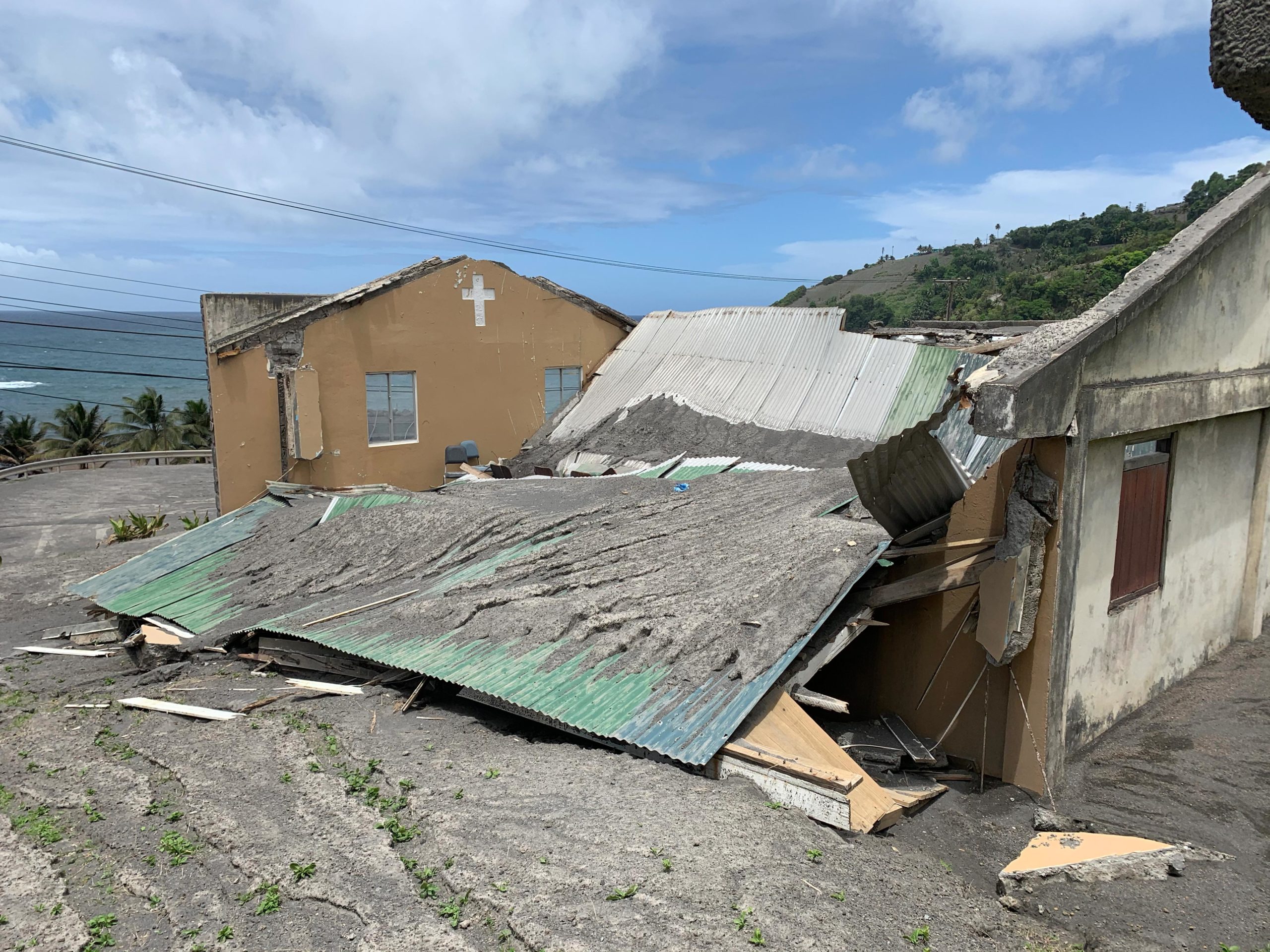
Roof collapsed due to accumulation of tephra. (Photo credit: R. Constantinescu, USF)
Damages to agricultural land from the accumulation of tephra. (Photo credit: R. Constantinescu, USF)
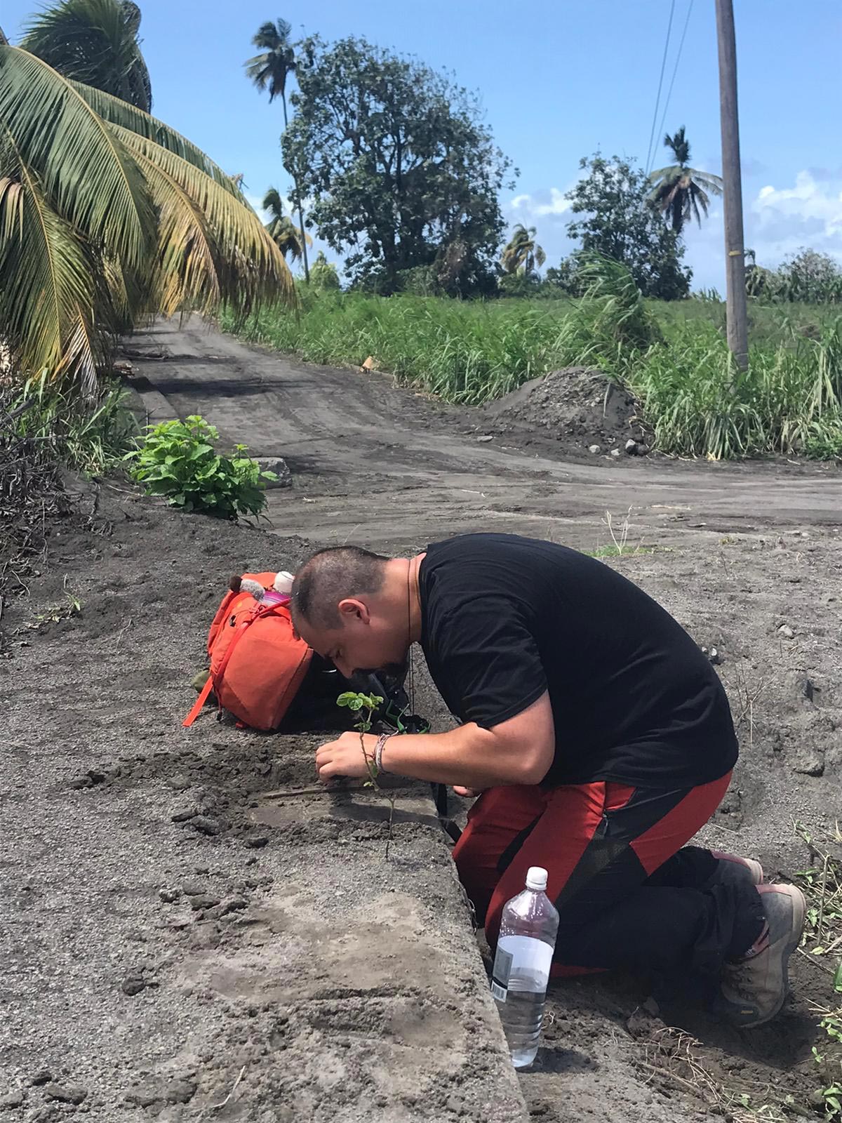
Robert collecting tephra samples on St. Vincent. (Photo credit: P. Cole)
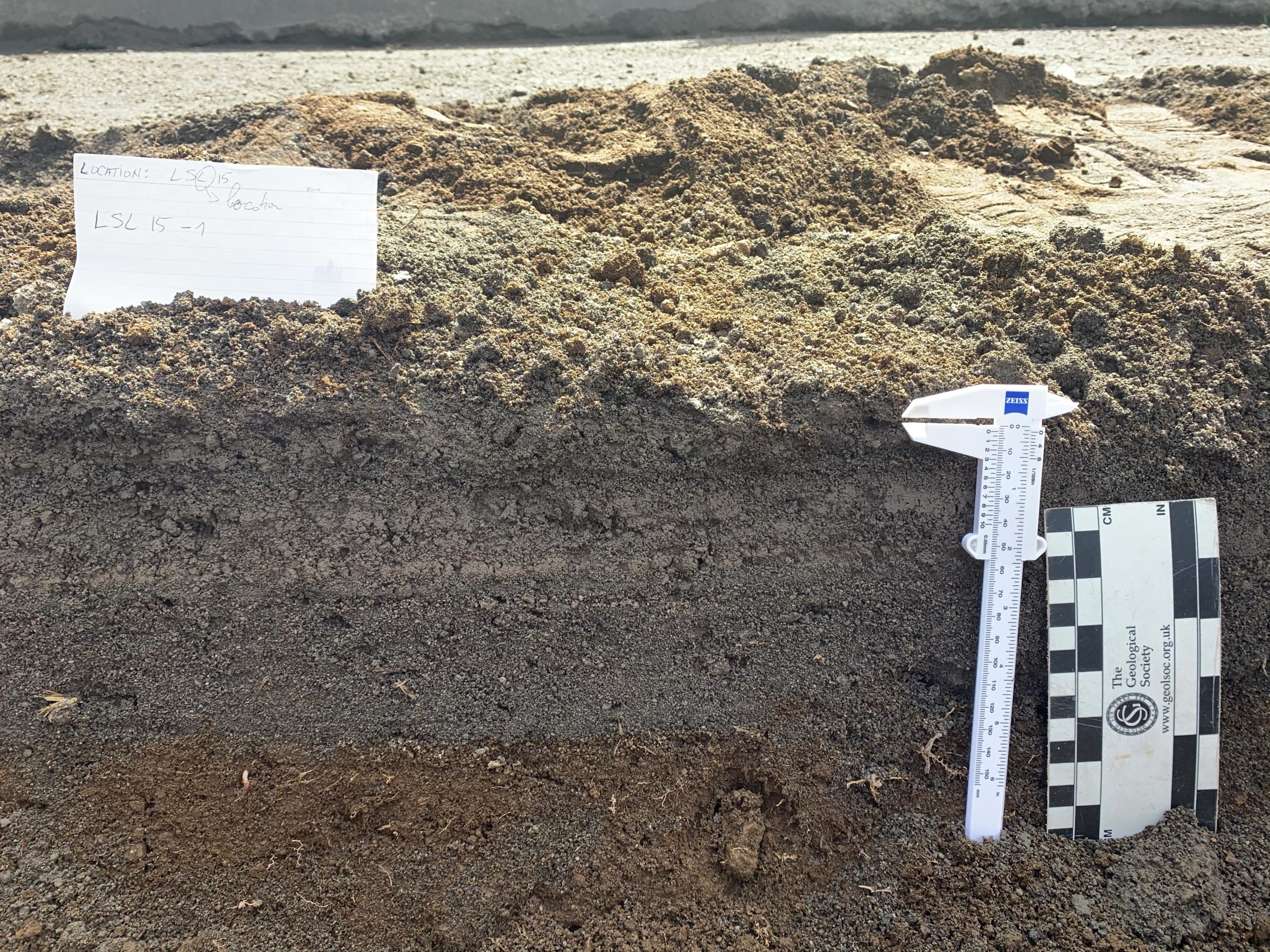
Taking thickness measurements for each tephra layer at a sampling location. (Photo credit: R. Constantinescu, USF)
Robert’s field work, along with the tephra model and the invaluable experience of our partners at USF, is the foundation for one of our GeoCode curriculum modules, called “Assessing Volcanic Hazards and Risk with Code.” This module engages high school students in exploring the tephra fall hazards at an active volcano and teaches them how to determine the associated risks to the nearby people and ecosystems. To do this, students use a block-based programming tool called GeoCoder to investigate how eruption magnitude and intensity affects the distribution of tephra fall deposits. By completing investigations, students engage in authentic scientific thinking that is similar to how scientists model eruptions and create hazard forecasts.
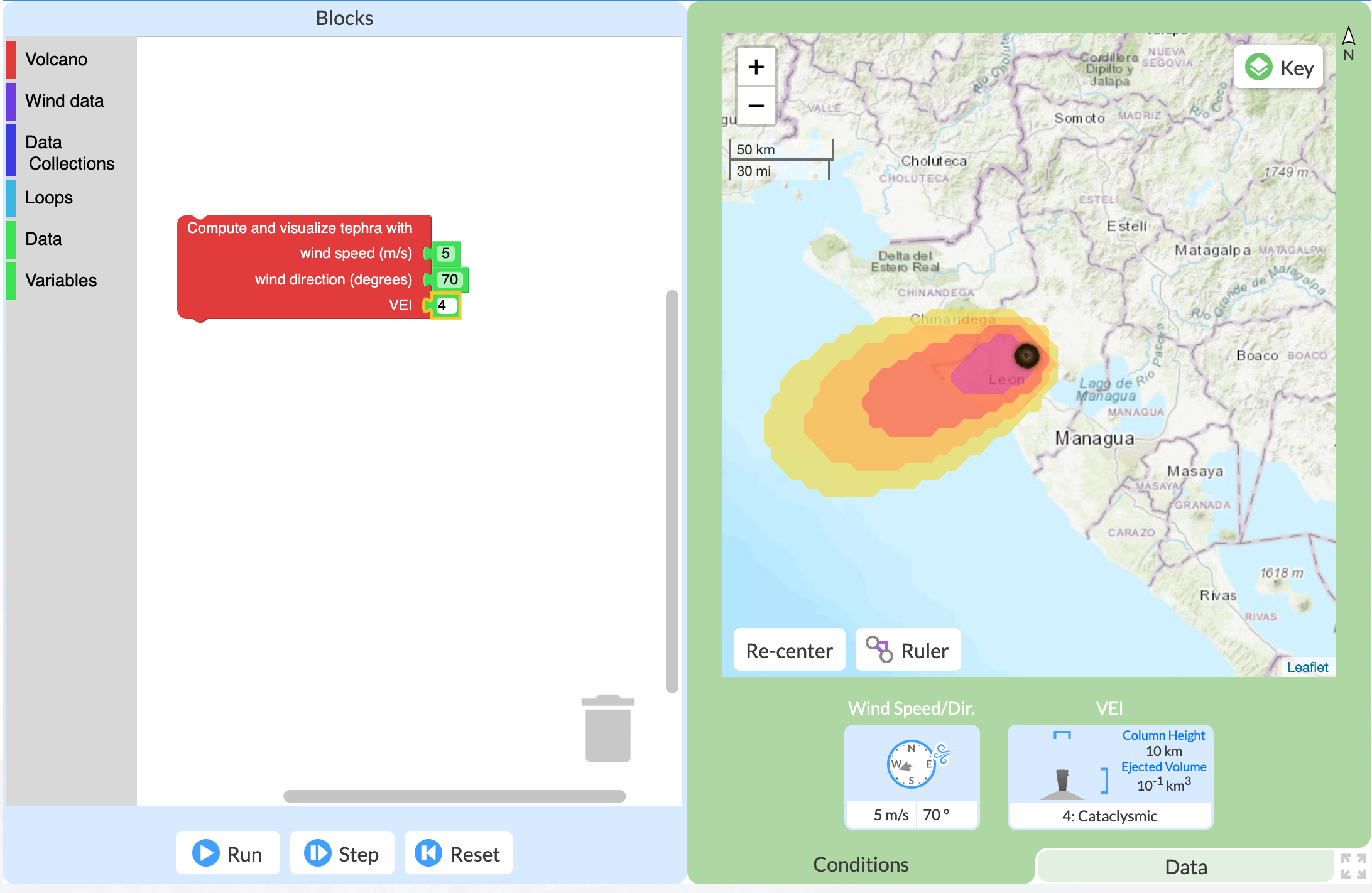
The GeoCoder in which students create code to model a tephra eruption and tephra distribution under differing conditions.
Robert created a presentation for our team and for the teachers and students who will use our curriculum materials. Learn how the work done by volcanologists like Robert is applied to the real world and how this knowledge is used in improving the forecast of future volcanic hazards.
We will be field testing our Assessing Volcanic Hazards and Risk with Code module during the 2021-2022 school year. If you are interested in trying this new approach to teaching about scientific practices and computational thinking, please let us know.