Chris Lore is a Research Assistant on the GeoHazard project at the Concord Consortium.
Julia LaCava is a summer intern at the Concord Consortium. A junior at Ithaca College, she majors in communications.
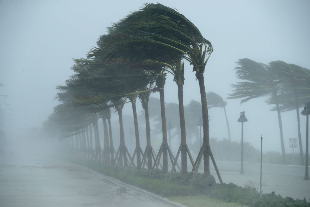
Hurricane Dorian slammed the Bahamas as a Category 5 storm, the highest of the five storm ratings, defined by sustained wind speeds over 157 mph. Gusts were measured at 220 mph. The damage from Dorian, the strongest storm on the planet this year, is catastrophic.
The Atlantic hurricane season historically runs from June 1 to November 30 as hurricanes form over the ocean, though they can form at any time of the year. So far this year there have been five named storms, including two hurricanes – Dorian and the Category 1 Barry, which struck Louisiana in July.
Due to our warming climate, there are more and more Category 4 and 5 hurricanes each year. Last month, NOAA increased the chance for an above-normal hurricane season for 2019. With a warmer atmosphere comes increased ocean temperatures. High sea surface temperatures are directly correlated with increased hurricane intensity because storms gain strength as they move over warm water. And as sea levels rise, so does the potential height of storm surges. While high winds can cause serious damage, storm surge is the most dangerous impact of hurricanes, inundating entire communities and causing flooding well inland.
Meteorologists and climate scientists have developed powerful models to help the scientific community better understand hurricane formation, growth, and motion, though hurricane prediction is still difficult. NOAA’s Earth System Research Laboratory notes, “great uncertainties still remain in the formulation of a few key model physics components that are critical to the development of hurricanes.”
The GeoHazard project at the Concord Consortium is currently building new tools and curriculum to help middle and high school students understand natural hazards and assess their risks. With our partners at Pennsylvania State University, National Geographic Society, and TERC, we are designing and developing the Hurricane Explorer. This novel and accessible model allows students to explore the variables that affect the track and intensity of hurricanes, as well as associated hazards when hurricanes strike.
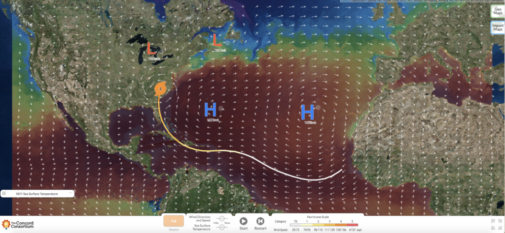
By adjusting variables in the model, such as the location and magnitude of high- and low-pressure systems, students can see how the trajectory of a hurricane can change. High and low-pressure systems influence atmospheric winds over the ocean, steering a hurricane as it travels west across the globe. Although the size and intensity of hurricanes is most often influenced by the temperature of water, pressure systems can also affect the strength of hurricanes.
Students can also explore the sea surface temperature and wind speed variability that results from adjusting the season (winter, spring, summer, and fall). Finally, students can investigate storm surge impact and precipitation levels at and around the area where the hurricane makes landfall. A population overlay map helps students consider the number of people that will be impacted by the hurricane.
The Hurricane Explorer will be embedded in a scaffolded curriculum module for middle and high school students that focuses on the guiding question, “How do rising global temperatures impact hurricane intensity and risk?” In the module, students will use the hurricane prediction and risk model as well as historical hurricane data to explore these powerful storms and their impact. The module is aligned with the Next Generation Science Standard HS-ESS3, which focuses on Earth and human activity.
The Hurricane Explorer model is now freely available. (Click the About link in the upper right of the model for simple instructions.)
If you are interested in pilot testing future GeoHazard resources, please sign up today!
If you are interested in tracking Dorian and future hurricanes, we suggest checking out the resources at Weather Underground.
We would like to thank our advisor, Jeff Masters, who consulted with us on the development of our hurricane model.