Category: Author: Christopher Lore
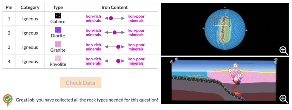
We’re thrilled to announce an updated release of the Rocks & Tectonics module! This module revolutionizes the teaching of the traditional rock cycle by connecting rock formation to plate motion and the tectonic conditions under which rocks form. The new version of the Rocks & Tectonics module incorporates new interactive feedback mechanisms designed to support […]
Symbols, objects, maps, graphs, and simulations are all powerful tools for conveying information. However, some complex ideas just can’t be captured in a single representation. In these cases, multiple visualizations can be used together to convey and connect several pieces of related information. For example, during the COVID-19 pandemic, news organizations used a combination of […]
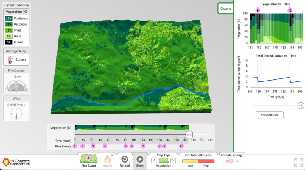
Massive amounts of Earth’s stored carbon is located in boreal forests, including those in northern Canada and Alaska. As temperatures rise and wildfires become more frequent, scientists are studying the boreal forest’s transformation from carbon sink to carbon source. We partnered with Dr. Brian Buma at the University of Colorado Denver and the Environmental Defense […]
Every education project funded by the National Science Foundation (NSF) is subject to flexible yet high expectations for the proposed research. NSF is investing in our ability to develop new technology, new curriculum, and new research that contributes innovative ideas and products to further the field of STEM education. When we are awarded an NSF […]
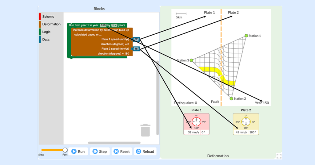
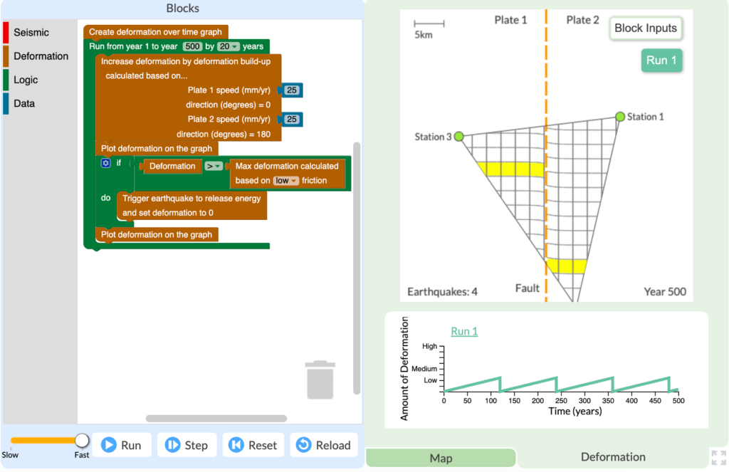
The everyday work of modern seismologists—the scientists who study earthquakes, hazards, and risks—exists right at the intersection of two NGSS practices: “Analyzing and Interpreting Data” and “Using Mathematics and Computational Thinking.” Seismologists collect huge amounts of data from satellites, remote sensors, and GPS networks in order to monitor Earth’s surface for signs of land movement […]
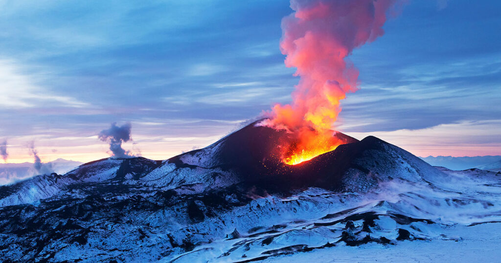
We are excited to announce that our GeoCode: Volcanic Hazards module is available for public use! This free two-week curriculum for middle and high school students has been piloted by participating research teachers as part of the National Science-Foundation funded GeoCode project and extensively studied and redesigned based on our research. It is now available […]
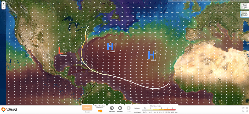
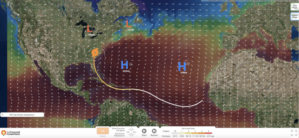
After weeks of tracking, prediction, and preparation, we watched Hurricane Isaias run its course and dissipate over northeast Canada. Now that the skies have cleared and the winds have passed, we know all that we can about Hurricane Isaias. We know that as a disorganized low pressure system moving east across the Atlantic, Isaias quickly […]
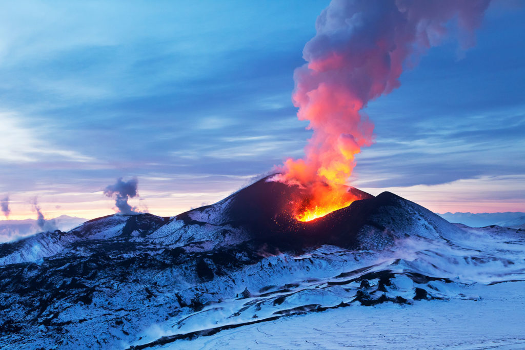
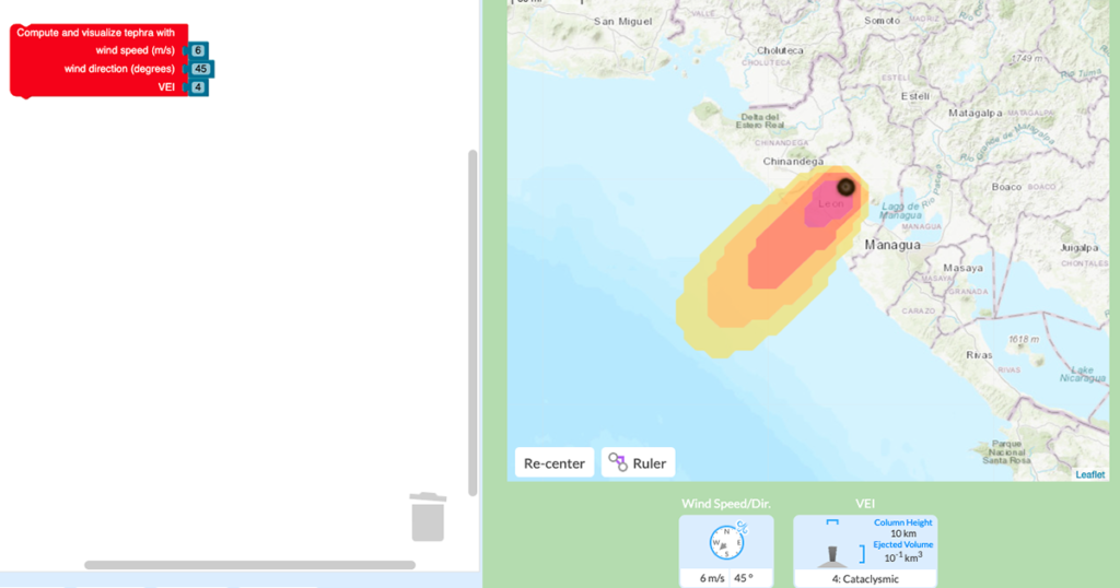
Volcanoes are some of the most impressive and unstoppable features on Earth. From the amazing artifacts at Pompeii to the photos of forests flattened by lava flows, the dangers associated with volcanoes are both terrifying and awe-inspiring. However, despite the risks, millions of people live in constant threat of damage to their homes, and more […]
Chris Lore is a Research Assistant on the GeoHazard project at the Concord Consortium. Julia LaCava is a summer intern at the Concord Consortium. A junior at Ithaca College, she majors in communications. Hurricane Dorian slammed the Bahamas as a Category 5 storm, the highest of the five storm ratings, defined by sustained wind speeds […]