Category: Earth Science Education

Last summer, thick plumes of wildfire smoke from northern Canada blanketed cities as far south as Washington, D.C., in an eerie orange haze. Record-breaking wildfires in provinces across Canada resulted in catastrophic damage to homes and communities, the destruction of more than 45.7 million acres of forest, and dangerously unhealthy air quality throughout the Northeast […]

2024 marks our 30th anniversary. Our origins reach back to a simple beginning, on a single-board computer with a mere one kilobyte of memory. But it’s not about the computer itself—it’s never just the technology. It’s what the computer made possible that matters. When Bob Tinker connected a KIM-1 computer to an expansion board he’d […]
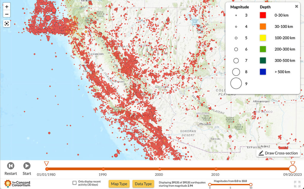
With most California residents living within a 30-minute drive of one of the state’s 500 active fault zones, the threat of earthquakes looms large. Scientists are constantly monitoring seismic activity, conducting risk assessments to determine when and where earthquakes may occur, and predicting the potential impacts to surrounding communities. Our new National Science Foundation-funded YouthQuake […]
Stephanie Seevers is an Earth science teacher in Colorado and a consultant on the TecRocks project. I was talking to my 9th grade Earth and Space Science students recently about why they think so many people lack a solid understanding of our planet and its history. We brainstormed ideas, and while several theories sounded valid, […]
Every education project funded by the National Science Foundation (NSF) is subject to flexible yet high expectations for the proposed research. NSF is investing in our ability to develop new technology, new curriculum, and new research that contributes innovative ideas and products to further the field of STEM education. When we are awarded an NSF […]
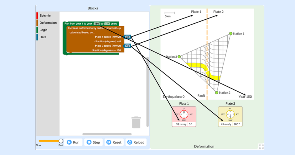
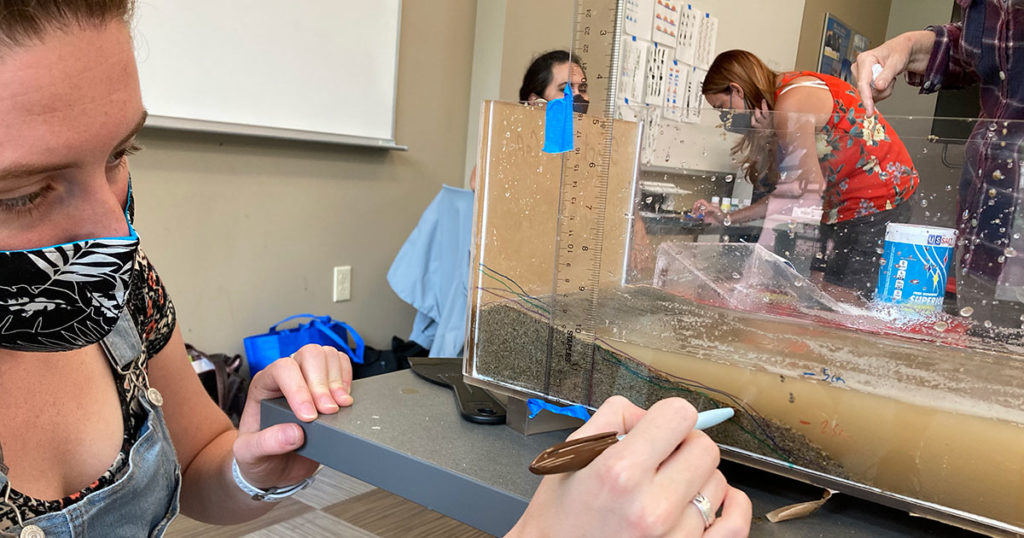
The everyday work of modern seismologists—the scientists who study earthquakes, hazards, and risks—exists right at the intersection of two NGSS practices: “Analyzing and Interpreting Data” and “Using Mathematics and Computational Thinking.” Seismologists collect huge amounts of data from satellites, remote sensors, and GPS networks in order to monitor Earth’s surface for signs of land movement […]
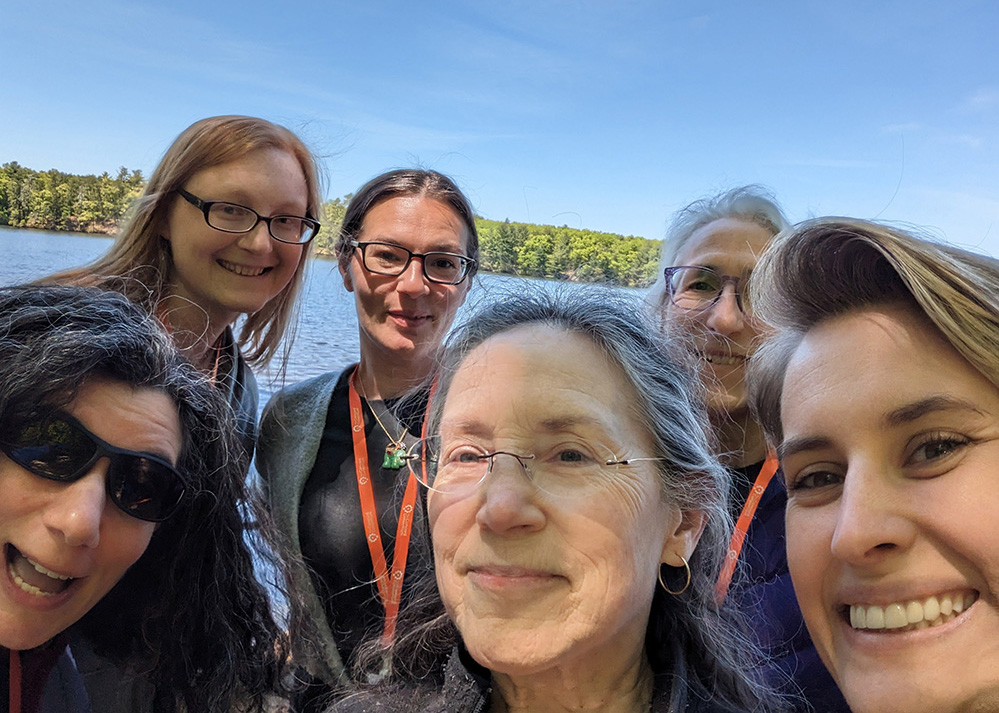
While our main offices are located in Concord, Massachusetts, and El Cerrito, California, nine of our 45 employees call other states home. Like many companies, we began working remotely during the pandemic and most of us continue to do so much of the time. But as an organization dedicated to innovating and inspiring equitable, large-scale […]

We’re delighted to present the year in review with our top 10 highlights. 1. We Update Our Workspaces Most of our employees now work remotely much of the time. While we love to collaborate over Zoom, in Google Docs, and on GitHub and Pivotal Tracker, we also enjoy getting together in person, especially in our […]
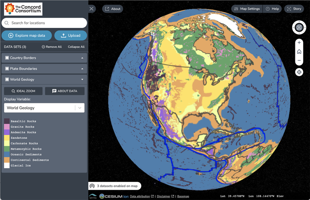
Traditional geologic maps beautifully illustrate the many different types of rock found on Earth’s surface. Geoscientists can look at a colorful geologic map and immediately spot important pieces of the story of Earth’s geologic history. For instance, in the map below, the red area found in Canada represents bedrock formed in the Late Archean Era […]
With Indigenous partners from both Alaskan and Hawaiian Native backgrounds, our NSF-funded project is co-designing a middle school curriculum to bridge Indigenous and Western science approaches to understanding the effect of climate change on coastlines.