Julia LaCava was a summer intern at the Concord Consortium. A junior at Ithaca College, she majors in communications.
We are excited to announce the public release of our new model-based curriculum that teaches plate tectonics like never before! “What will Earth look like in 500 million years?” was developed by our Geological Models for Explorations of Dynamic Earth (GEODE) project. Funded by the National Science Foundation, GEODE is a partnership between the Concord Consortium and Pennsylvania State University focusing on helping students understand what happens both on and below Earth’s surface as plates move and interact with each other.
The curriculum module helps middle and high school students learn that Earth’s surface is a dynamic system with interconnected parts (Earth’s plates) that create phenomena like volcanic eruptions and earthquakes. Our unique approach features plate tectonics as the mechanism used for exploring many Earth science phenomena rather than as the capstone concept that pulls the topics together at the end of a unit. The goal is to help students understand how plate movements and interactions are responsible for features such as mid-ocean ridges and mountains, and events such as volcanic eruptions and earthquakes.
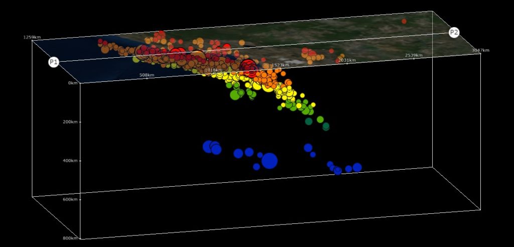
The module is built around two innovative tools: the Seismic Explorer and the Tectonic Explorer. The Seismic Explorer allows students to manipulate a visualization of up-to-date seismic and volcanic data from the United States Geological Survey (USGS) and the Smithsonian Institution Global Volcanism Program. Students can create cross-sections of the Earth to view patterns of earthquake depths. Students use Seismic Explorer to build hypotheses of the behavior of tectonic plates and how they help create landforms and events around the world.

Cross-section of earthquakes in Seismic Explorer.
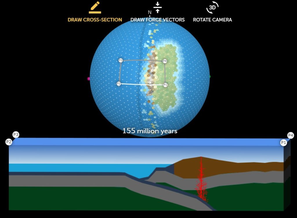
Students’ hypotheses are then tested with the Tectonic Explorer. This 3D dynamic model allows students to explore how the movement of tectonic plates and their interactions shape a planet’s surface features, such as mountains, trenches, and volcanoes. Students set up different scenarios to test ideas, examining how boundaries behave and the kinds of landforms they can produce. To better observe the interactions both at and below the surface, students create cross-sections. The Tectonic Explorer is unlike anything Earth science education has seen before, as students are in charge of the initial parameters of the model.

Cross-section of a plate boundary in Tectonic Explorer.
Seismic Explorer and Tectonic Explorer work hand-in-hand with the online module. For example, students consider how prominent landforms such as the Andes Mountains in South America were created. Students are also asked to experiment with diverging plate boundaries to understand how the Red Sea was formed and its continuous widening.
GEODE is transforming plate tectonics education. In the past, it was nearly impossible for teachers to engage students in the visualization of tectonic plates or to establish the idea that Earth’s surface is a dynamic system in constant motion, as plate movement is a process that takes millions of years and cannot be reproduced in a lab setting. Our new module makes Earth science models accessible to secondary students who develop their understanding of plate movement through an inquiry-based approach. The module is designed for approximately seven class periods, and activities should be completed in order.
One thought on “What will the Earth look like in 500 million years?”
Comments are closed.
Really helpful