Julia LaCava was a summer intern at the Concord Consortium. A junior at Ithaca College, she majors in communications.
Imagine being able to set up a simulation of an Earth-like planet to explore tectonic plate movement and see the results of plate interactions. Now your students can do just that, thanks to our new Tectonic Explorer model!
The theory of plate tectonics is essential to understanding many of Earth’s phenomena such as earthquakes, volcanic eruptions, and the formation of mountains. Plate tectonic theory provides explanations for why geological events happen and helps geoscientists make predictions about what might happen in the future.
Despite its importance, plate tectonics remains one of the hardest concepts to teach students. The biggest challenge lies in the scale of these phenomena. Large plates of Earth’s crust make imperceptible shifts all the time, moving millimeter by millimeter. Over millions of years, these movements create dramatic changes to Earth’s surface. This process is difficult for students to imagine, but interactive models can make it more tangible.
We believe that using interactive models as a central part of instruction has the potential to support science learning for students by making complex systems more accessible. Dynamic models of Earth systems can help students understand the underlying mechanisms and physical processes that shape Earth’s surface. They allow students to experiment and observe emergent phenomena that would otherwise be invisible. Making this process possible in Earth science education is the driving force behind the creation of the Tectonic Explorer by the Geological Models for Explorations of Dynamic Earth (GEODE) project. The goal of the project is to enable students to understand the Earth’s surface as a dynamic system with multiple moving parts interacting at all times.
Tectonic Explorer is a free, web-based 3D dynamic model designed to help students reason about the mechanisms responsible for geologic events and landforms and think about plates as a system interacting on all boundaries. Typically, students learn about plate boundaries individually and are not asked to consider what is happening along other boundaries at the same time. As far as we know, Tectonic Explorer is the first model of its kind.
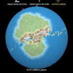
While experimenting with the model, students can create their own simulation with up to five interacting plates, draw continents, and apply force vectors to individual plates. They can watch oceans close, continents collide, mountain ranges form and islands develop, all from a model they create and manipulate. Students can observe a divergent boundary on one side of a plate, along with the formation of mid-ocean ridges, and clearly see a convergent boundary on the other side as well as formations of trenches and volcanic arcs. What makes this tool unique is that it allows students to think about these boundaries as part of a system of interacting plates instead of learning about each plate boundary in isolation.
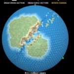
Formation of a mountain range along a convergent boundary using Tectonic Explorer.
Students can also draw a cross-section and explore simple and complex interactions at and below the surface. Students can see plates diverging, and magma rising along the mid-ocean ridges or plates converging and the subduction of one plate below another.
Tectonic Explorer has been combined with GEODE’s Seismic Explorer in the online GEODE curriculum that explores the framing question: “What will Earth look like in 500 million years?” The module is designed to help students think like a geoscientist while studying our dynamic Earth. The models and curriculum module are freely available on our STEM Resource Finder.
One thought on “Teach plate tectonics with Tectonic Explorer”
Comments are closed.
This is very cool! If I may leave a feature request: An export to png or so, as an equirectangular map, would be awesome. That way the simulated planets could be used in other tools or for fantasy mapmaking.