Category: Research Projects
In collaboration with the American Meteorological Society and Physics Front, the ISLAND project will develop Hazbot, a personalized automated feedback system powered by AI and designed to scaffold students’ scientific inquiry into natural hazards.
In partnership with Middle Tennessee State University, we are developing a master’s plus program that integrates coursework in leadership and data science education. LEADS is designed to develop teacher competency, recognition, belonging, and identity.
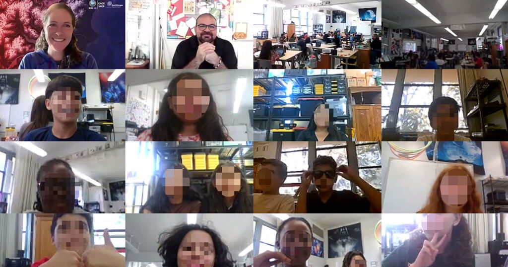
Shelley Olds is an instructional designer at EarthScope Consortium and a partner on the YouthQuake project. Generating thoughtful questions—and building the confidence to ask them—is a cornerstone of scientific inquiry. Middle school students in the YouthQuake project had the rare opportunity to ask geoscience professionals about their journeys into STEM careers and explore their own […]
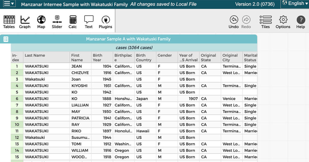
Middle school social studies students typically study 20th century immigration, including the push and pull factors that guided immigration and the policies that shaped travel to (and from) the United States. Additionally, Jeanne Wakatsuki Houston’s memoir Farewell to Manzanar, which details her experience in a Japanese American internment camp during World War II, is a […]
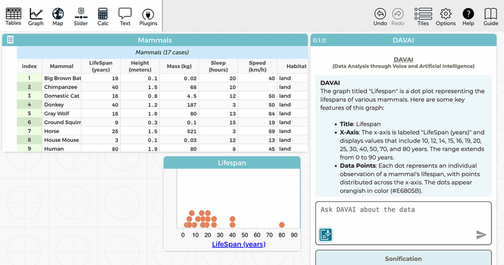
Our Common Online Data Analysis Platform (CODAP) engages learners in data science practices, including data analysis and visualization. But what does “visualization” mean to blind or low-vision (BLV) learners? A new National Science Foundation-funded project is using artificial intelligence (AI) to develop and research new tools for making data exploration accessible to BLV learners. Graphs—and […]
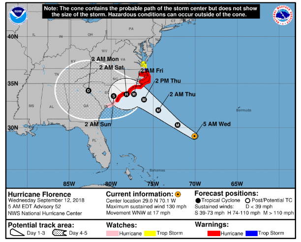
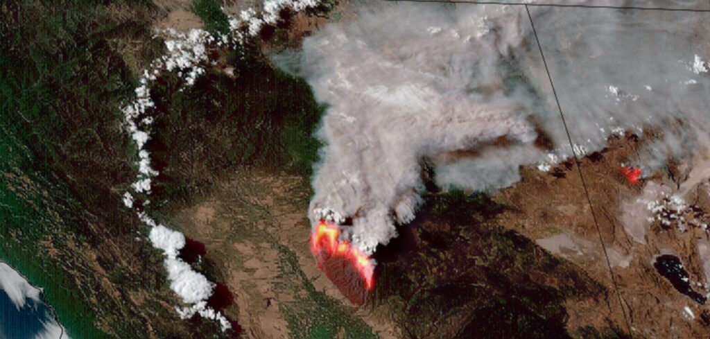
At the Concord Consortium, we believe that science education should reflect the dynamic, uncertain, and inquiry-driven nature of science itself. In our recently published study in the International Journal of Science Education, we explore how middle and high school students engage in hurricane science by interacting with the very tools scientists use to reason about […]
Joe Polman is the Associate Dean for Research and a Professor at the University of Colorado Boulder. Kate Miller is a Research Associate. Cynthia McIntyre is the Director of Communications. Over the course of two years, our National Science Foundation-funded Contextualizing Data Education via Project-Based Learning (DataPBL) project co-designed addenda to four middle school English […]
Trang Tran is a Research Assistant Professor at the University of Alaska Anchorage. Joe Polman is the Associate Dean for Research and a Professor at the University of Colorado Boulder. Kate Miller is a Research Associate. Cynthia McIntyre is the Director of Communications. A new National Science Foundation-funded study investigated how interdisciplinary, project-based learning can […]
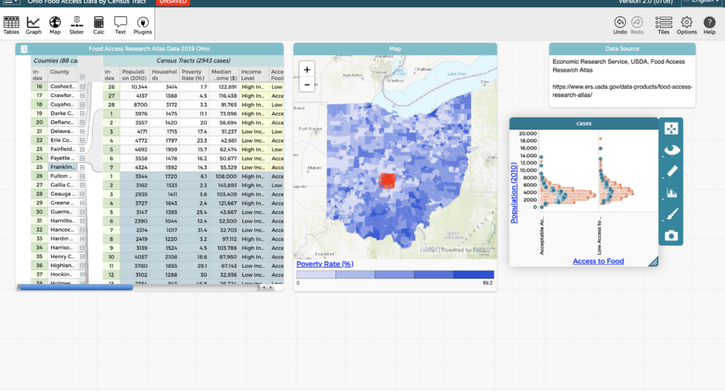
From climate reports to historical datasets about income or education level, data influences how we understand and interact with the world around us. While math and science classrooms often shoulder the responsibility of teaching data skills, social studies classrooms are uniquely positioned to offer a context-rich and interdisciplinary approach to data literacy. At its core, […]
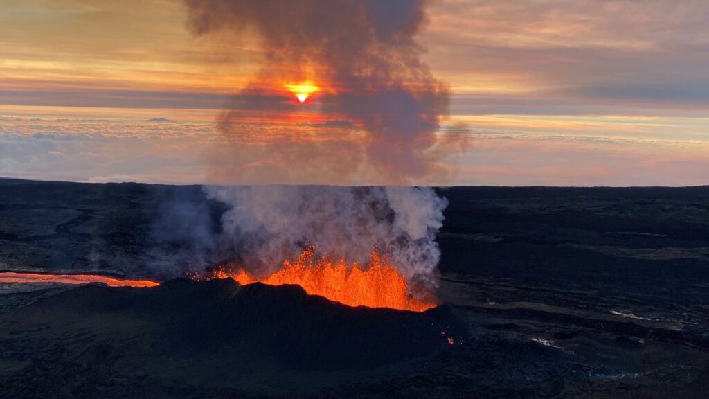
Hawaiʻi’s iconic volcanoes have shaped its islands, culture, and communities for centuries. From the breathtaking eruptions of Mauna Loa to the challenges of living with air pollution caused by the eruptions (known as “vog”), volcanic activity is an intrinsic part of life in Hawaiʻi. What if students could harness computational tools to better understand volcanic […]