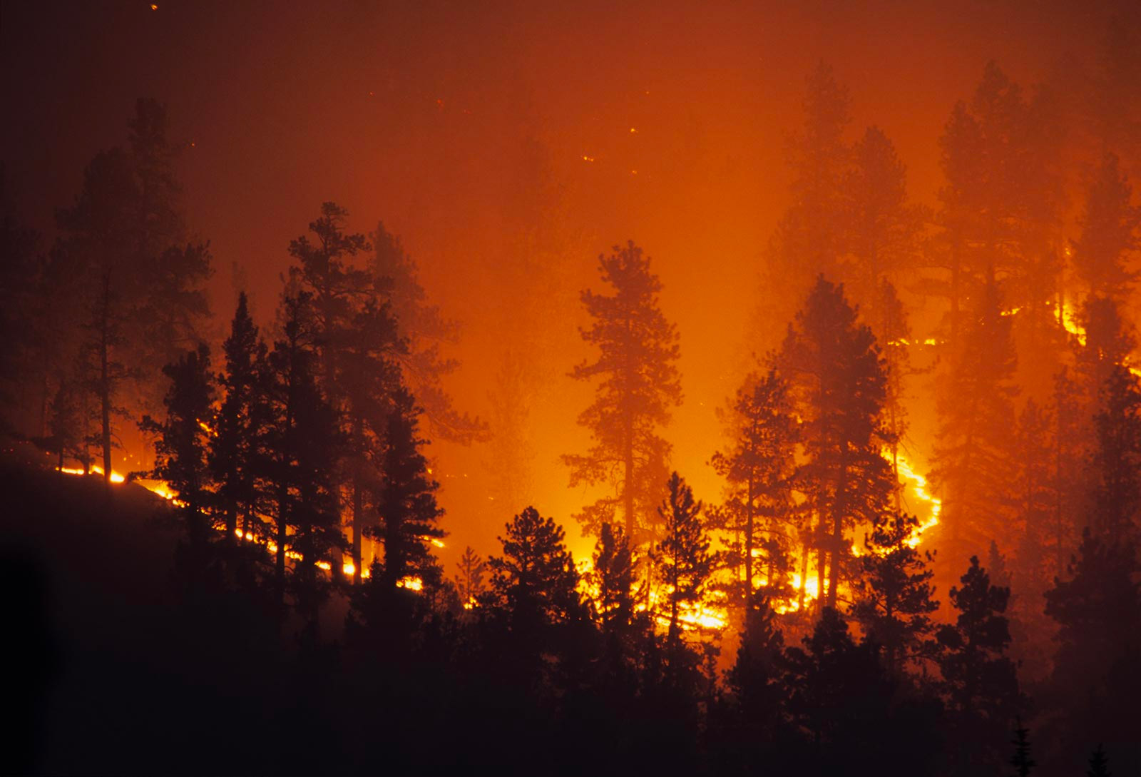
It used to be that natural disasters like wildfires, floods, and hurricanes each had their own season, likely to occur in predictable locations and at certain times of the year. Changes in the climate have expanded and shifted both the map of where people may be at risk and the months when these hazards most frequently strike. In today’s news alone, you can read about wildfires raging in California, record flooding in Pakistan, and a tropical storm threatening Florida.
Over the past few weeks, teachers have returned to the classroom. Though they hope for a normal year after a global pandemic, many are faced with new challenges. Some schools in Kentucky have not yet reopened due to flooding while others in Washington closed this week to avoid exposure to wildfire smoke. Teaching natural hazards to students who may be all too familiar with their impacts is among the many harsh realities that face teachers. When schools do open, students and teachers alike will share their personal experiences and ideally will discuss the socioscientific aspects of these events, especially if they impact people in their community.
Teaching Risk and Uncertainty
While tragedy has struck an inordinate number of students in the past several years, not all areas of the country are at risk for every natural hazard all the time. To avoid having students feel like Chicken Little under a falling sky, the GeoHazard project uses simulations, data, experimentation, and scientific argumentation to teach about risk and uncertainty. We have created three scaffolded online modules focused on hurricanes, wildfires, and inland flooding to help teach these concepts. Through investigations using both simulations and real-world data, these curriculum units introduce students to the scientific factors responsible for these hazards and provide practice in interpreting forecasts. The end goal is to bolster students’ confidence in their ability to make reasonable assessments about risk.
When talking about risks related to natural hazards, students must consider both the likelihood of the hazard occurring and the severity of the impacts that the hazard may have. For example, a 500-year flood may be less likely to happen, but if it did it would result in catastrophic loss for a river community. That was fine when extreme floods rarely occurred, but what happens when “500-year floods” happen every few years? The risk assessment changes. We have found that considering risk means making a forecast that inherently includes some level of uncertainty. This means teaching scientific uncertainty is particularly important when talking about natural hazards, especially when considering the potential effects that climate change may have on the frequency and severity of these events.
Throughout each module, students are prompted to construct scientific arguments in the claim-evidence-reasoning (CER) format. In our modules, we make room for uncertainty based on limitations in the data presented as well as other unknown factors. At different points, students are presented with data or are asked to generate data using a simulation. They are then asked to make a claim, write an explanation, and then rate their level of uncertainty. Sometimes, they are asked to explain their uncertainty. Other times, they are asked to think of ways to improve their certainty. Our goal is to move students from explanations of personal uncertainty (“I just know it’s going to happen!”) toward explanations of uncertainty that exhibit scientific reasoning. We structured the argumentation tasks around four distinct types of uncertainty attributions.*
Temporal uncertainty is uncertainty in identifying patterns in the past using data from the past as well as uncertainty in making predictions or forecasts about the future.
Structural uncertainty is uncertainty in complexity when models are used to describe and explain a natural phenomenon.
Metrical uncertainty is uncertainty in measurement. It arises during data collection and analysis.
Translational uncertainty is uncertainty in explaining and communicating uncertain results with people who take different perspectives and stakes in the community.
Temporal Uncertainty
In the GeoHazard modules, students are asked to examine graphs of past events, look for trends in the data, and make predictions about what might happen in the future. Graphs, however, are only one view into data, and may be limited, not including all the relevant information needed to make predictions. For example, with precipitation data in the United States, graphs that show averages in the southwest region of the country may not accurately reflect what’s happening in the Midwest. Within the activities, students are frequently presented with multiple graphs and diagrams around the same concept, like rising global temperatures, to provide data needed to make predictions. Even so, students may be uncertain about whether or not trends from the past always continue into the future.
Structural Uncertainty
Each module contains an embedded simulation of a natural hazard. Students can set up the simulation with varying parameters and then investigate the effect of parameters such as sea surface temperature on Atlantic hurricane tracks, the result of drought and high winds on wildfire spread, and the consequences of increased precipitation on flooding in cities built around rivers. However, by their very nature, simulations cannot include every possible variable. As students simulate these natural hazards, they can gain an understanding of which factors make a hazard more or less severe. Structural uncertainty can arise when students explore these factors. For example, in the Hurricane Module, students adjust the location and magnitude of air pressure systems in the Atlantic to mimic the track of a past hurricane. However, hurricanes are a complex weather phenomenon that can emerge, grow, and change their path based on many other variables that are not included in the simulation.
Metrical Uncertainty
This type of uncertainty involves calculating the likelihood of hazard events occurring. Probability, statistical calculations, confidence levels, and error analyses are inherent in metrical uncertainty, though we do not ask students to make direct calculations. We do, however, present scientists’ calculations of risk. For example, a flood map illustrates a community’s risk of inundation using variables like flood frequency, stream discharge, distance to a water source, and elevation. In a summative activity, students use a flood map along with what they have learned in the module to determine the risk to certain areas in the city based on elevation, surface permeability, distance from the river, and rainfall. But risk involves not only the likelihood of a hazard, but also takes into consideration the potential for loss. Students consider risks to areas like public parks, busy city hospitals, or airports. They also engage in building levees to protect certain areas of the city, sometimes finding that they calculated the likelihood of flooding only on one side of the river, leaving the other side with even more severe impacts.
Translational Uncertainty
While wildfires and hurricanes have more direct links to climate change, scientists note that extreme rainfall events are also becoming more frequent as rising global temperatures lead to more rainfall in some areas. In fact, the most recent National Climate Assessment indicates that there will likely be an increase in extreme rain and subsequent floods in the American Midwest and Northeast. Most Americans now believe that climate change is real. However, translational uncertainty can manifest itself in students’ interpretation of the causes of climate change, which may depend on their political leanings and exposure to partisan media. Without attributing this change to human activity, it is difficult for students to see any hope of remediating risk. Students may struggle with this type of uncertainty. Through our teacher materials, we encourage teachers to discuss uncertainty and risk and the ways that explanations in science evolve based on new data. We also stress the importance of talking about sometimes sensitive socioscientific issues around climate change and natural hazards and provide tips on how to support this type of discourse.
Research
We have collected data on our modules from hundreds of teachers and thousands of students. Each of our modules has shown promising results in teaching students the scientific concepts behind natural hazards. In our final classroom implementation period, we are collecting data to specifically answer the following questions:
- How do students use scientific uncertainty to assess risks based on their understanding of a natural hazard system?
- How do students quantify and explain risks to people and their communities and compare different sources of risks?
Now, more than ever, it is important for students to understand the concept of uncertainty and be able to attribute their own uncertainty to scientific rather than personal or other external factors.
GeoHazard Materials
Each GeoHazard module contains five activities and is designed to take approximately five class periods. Assessments, teacher support materials, including an online teacher edition and real-time class dashboard, are available on the following resource pages:
* Rowe, W. D. (1994). Understanding uncertainty. Risk Analysis: An International Journal, 14(5), 743–750.