Earthquakes occur worldwide daily, and their aftereffects vary widely, from minimal to devastating. From California to the Mediterranean, some communities live with the threat and consequences of earthquakes and their aftershocks on a regular basis. Understanding what causes an earthquake is not easy. How is it possible to visualize monumental slabs of Earth moving? And why do we need to?
On June 12, 2017, newspapers worldwide reported on a 6.3 magnitude earthquake south of the island of Lesbos, Greece (off the western coast of Turkey). The quake caused widespread structural damage as well as loss of life, and it drew considerable attention, in part, because of the large number of migrants on Lesbos. How to house and care for the affected migrants and residents became a major international challenge.
But according to the USGS, the earthquake was “the result of normal faulting in the shallow crust.” The Lesbos quake was traumatic, but not unexpected. Greece and Turkey are particularly earthquake prone because they are on active fault lines. The Mediterranean region is seismically active due to the convergence of the African plate to the south with the Eurasian plate to the north. The African plate is subducting beneath the Eurasian plate at a place called the Hellenic Trench.
That’s a lot to understand, let alone visualize. When a seismic event occurs, how can a teacher explain such monumental movements of the Earth to middle school students? Typically, it’s been done with drawings and detailed descriptions, such as the excellent resources available from the USGS. But earthquakes and other geologic events are about movement, happening far out of sight. The Concord Consortium’s GEODE project is creating a way to visualize the Earth’s movements using an interactive, dynamic computer model of tectonic plates.
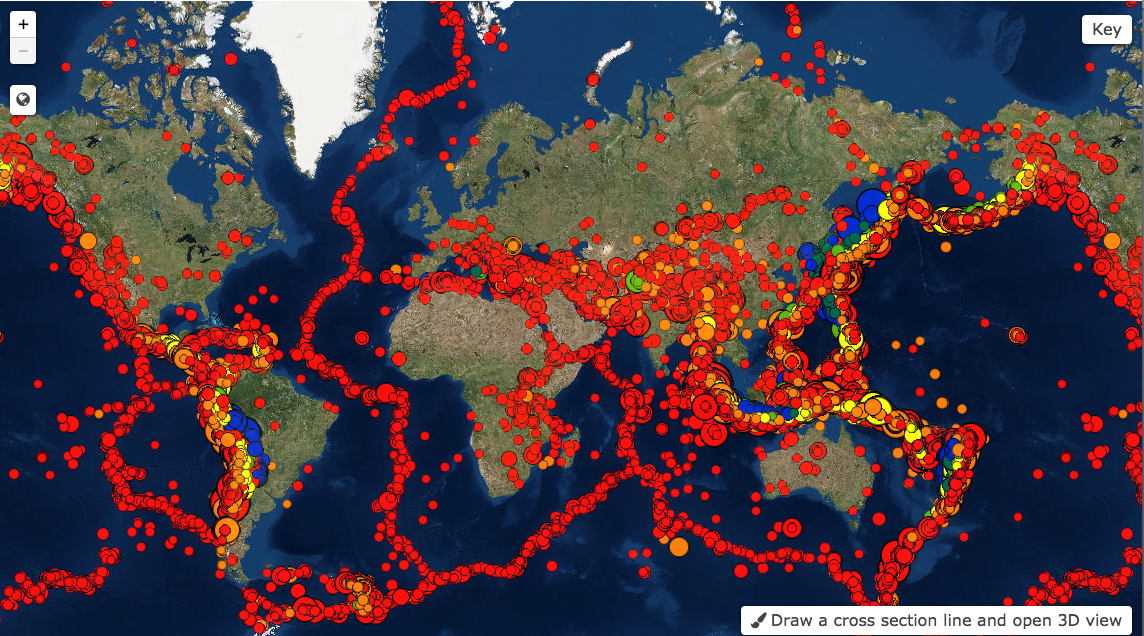
Another GEODE model — the Seismic Explorer — allows users to see the pattern of earthquakes worldwide, including their magnitude and depth. The Lesbos quake and many others, as well as towns and cities, are visible.
The GEODE project is still researching and developing the best ways for kids to learn about Earth’s big movements. But why is it important? Because the consequences of these movements can crumble buildings and cause loss of life. Understanding patterns of Earth’s movement may help lead to better forecasting, preparedness, and response.