Geoscience poses many questions. Why are there continents and oceans? How do mountains form? Why do volcanoes form in some areas and not others? What causes earthquakes to be more frequent in some areas than others? Why are oil, diamond, gold, and other deposits clustered in particular areas rather than being spread evenly across the world?
Teaching geoscience poses significant challenges. Experiments with Earth’s geology are impossible, and many of the natural processes that shape Earth, such as sedimentation, folding, and faulting, take place out of sight, over unimaginably long time periods. We think that technology has the potential help to transform how geoscience is taught and understood.
From the people who brought you High-Adventure Science comes the GEODE (Geological Models for Explorations of Dynamic Earth) project. Funded by the National Science Foundation, the new project aims to design dynamic, interactive, computer-based models and curricula to help students understand how Earth’s surface and subsurface features are shaped. As in the High-Adventure Science modules, GEODE modules will incorporate real-world data and computational models, with a focus on making scientific arguments based on evidence.
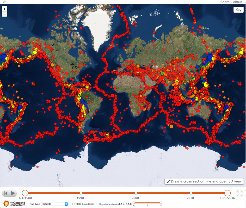
The GEODE project, a partnership between the Concord Consortium and The Pennsylvania State University, held a kickoff brainstorming session Monday, September 27. Principal Investigator Amy Pallant and Co-PI Hee-Sun Lee, both of the Concord Consortium, and Co-PI Scott McDonald of Penn State organized a meeting to begin developing a plate tectonics model to accompany the recently developed Seismic Explorer.
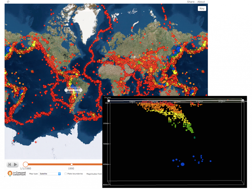

Professional geologists, geoscience educators, and software developers reviewed the currently available models and simulations of plate motion, earthquake waves, sedimentation, folding, and faulting, and discussed ways to make these concepts accessible to middle and high school students.
We look forward to sharing more models and activities as they are developed over the next few years!