Category: Research Projects
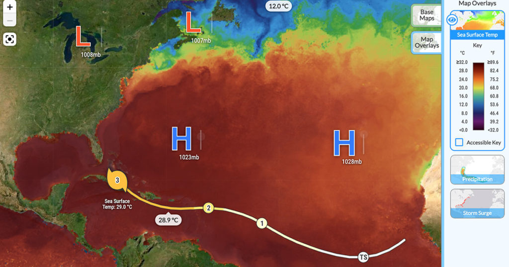
Climate change, and the rise of the natural hazards that climate change brings, has been at the top of news feeds every week over the past year. Extreme events such as floods, droughts, and wildfires are expected to increase in the future. What does that mean for those of us living in the path of […]
We recently revised our mission and vision statements, and described our efforts to address issues of diversity, equity, inclusion, and justice in several of our research projects. We know that this was only a beginning. As we said, “We are still learning how to design science, technology, engineering, and mathematics resources that are more socially […]

We’re scaffolding students as they engage in mathematical modeling with the M2Studio learning environment that integrates and extends CODAP and SageModeler, and provides a canvas for student agency and creativity.
Positioning middle school students in a culturally congruent epistemological stance (student-as-anthropologist), allowing them to build Earth science learning from both Indigenous knowledge as well as Western-style inquiry.
In collaboration with Rutgers University, UNC Greensboro, and middle school students and teachers in New Brunswick, New Jersey, we are investigating the development and implementation of life science materials that support local, consequential learning.
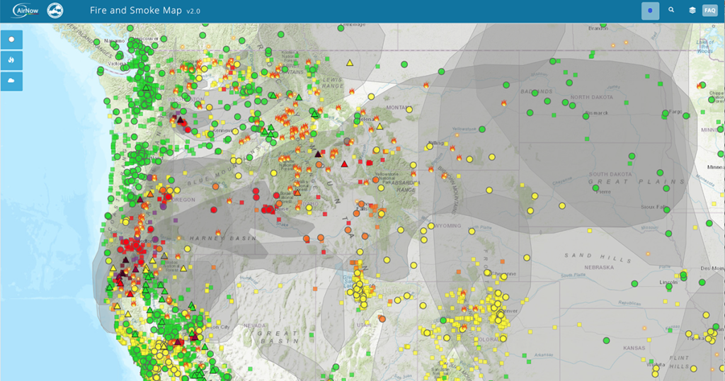
The American West is burning. Wildfires rage, firefighters battle to contain fires, families are forced to evacuate their homes, and smoke chokes neighborhoods hundreds of miles away. Multiple years of drought have desiccated trees, shrubs, and grasses and transformed the western United States into a tinderbox. Air Quality Index and active fires in the western […]
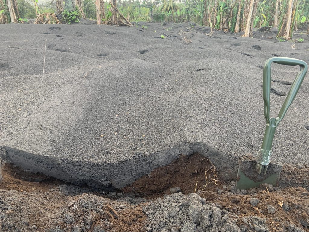
Robert Constantinescu, a Ph.D. candidate in volcanology at the University of South Florida (USF), flew to the island of St. Vincent after the explosive activity at the La Soufrière volcano subsided. Between May 1 and 13, 2021, he worked alongside local scientists from the Seismic Research Centre of the University of West Indies to collect […]
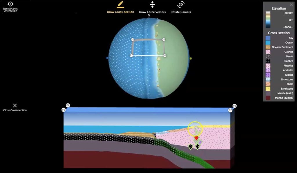
The rock cycle, presented in nearly every Earth science curriculum and textbook, is typically taught in the same way from one classroom to the next. Students are shown an image that summarizes how all rocks are related to each other with suggested pathways by which one rock can transform into another rock. A nice, simple […]
We are delighted to celebrate five years of partnering with the world-renowned National Geographic Society. The National Geographic Society uses the power of science, exploration, education, and storytelling to illuminate and protect the wonder of our world. At the Concord Consortium we envision a world where teaching and learning seamlessly incorporate the best features of […]
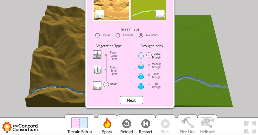
“A new fire has started every day in Utah since May 17. Hot, dry conditions mean more could spark soon.” This was the shocking headline of a June 10 article about wildfires in one Western state. The National Interagency Fire Center, the nation’s support center for wildland firefighting, is currently tracking large fires in Utah […]