Earth’s landforms have been shaped over hundreds of millions of years by the movement and interaction of Earth’s tectonic plates. While geoscientists can correlate the wide variety of landforms to this movement, teaching about it poses significant challenges. It’s hard for students to reason spatially and temporally about such processes.
One of the goals of the GEODE project is to design an interactive, dynamic plate tectonics model. Plate tectonics is a fundamental theory that unifies Earth science. It describes Earth’s surface as consisting of a number of “plates” that pull apart, move towards each other, or move side by side. These interactions are responsible for the formation and distribution of geologic phenomena.
Creating a model to represent the complex Earth system is no simple task. We wrote about the challenges of starting with a 2D version in Modeling Plate Tectonics for Learning, but decided to abandon that approach in favor of a 3D model. While visualizations of Earth’s plates exist, a 3D dynamic, interactive plate tectonics model based on physics that runs on school-based computers did not. Until now.
We have begun work on a new 3D GEODE model. The beta version already simulates the following geological processes:
- subduction and related volcanic activity
- continental collision and orogeny
- forming of a new oceanic crust at divergent boundaries
Play the video to watch GEODE’s new 3D geodynamic model representing interacting plates on a modeled planet.
The plates are modeled as rigid bodies that rotate around the center of a planet. Plates are built from small, hexagonal fields with various geological properties:
- crust type (oceanic or continental)
- elevation (which can be changed by volcanic activity or orogeny)
- geological data describing processes like subduction, volcanic activity, or orogeny
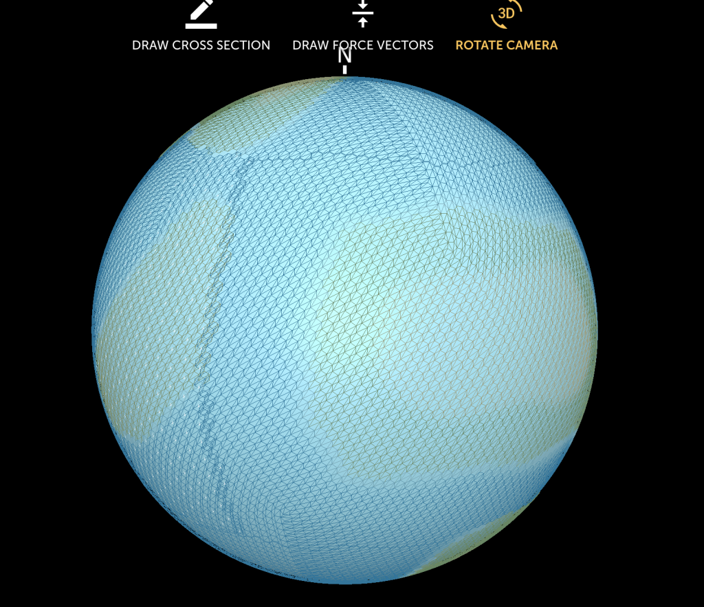
Plates are built from small, hexagonal fields that interact based on a physics engine that updates the forces for each hexagon
Every step of the simulation is based on a physics engine that updates the forces for each hexagon. In addition, the final torque (sum of all torques coming from the hexagonal forces), angular accelerations, and angular velocities are calculated for each plate modeled. As plates interact along the plate boundaries, the model detects either the need to generate new fields (hexagons) where plates move apart—like what happens along mid-ocean rifts—or detects collisions and determines what processes are happening—for example, subduction, mountain building, volcanic activity.