Monday’s Lesson: Tephra in the Wind
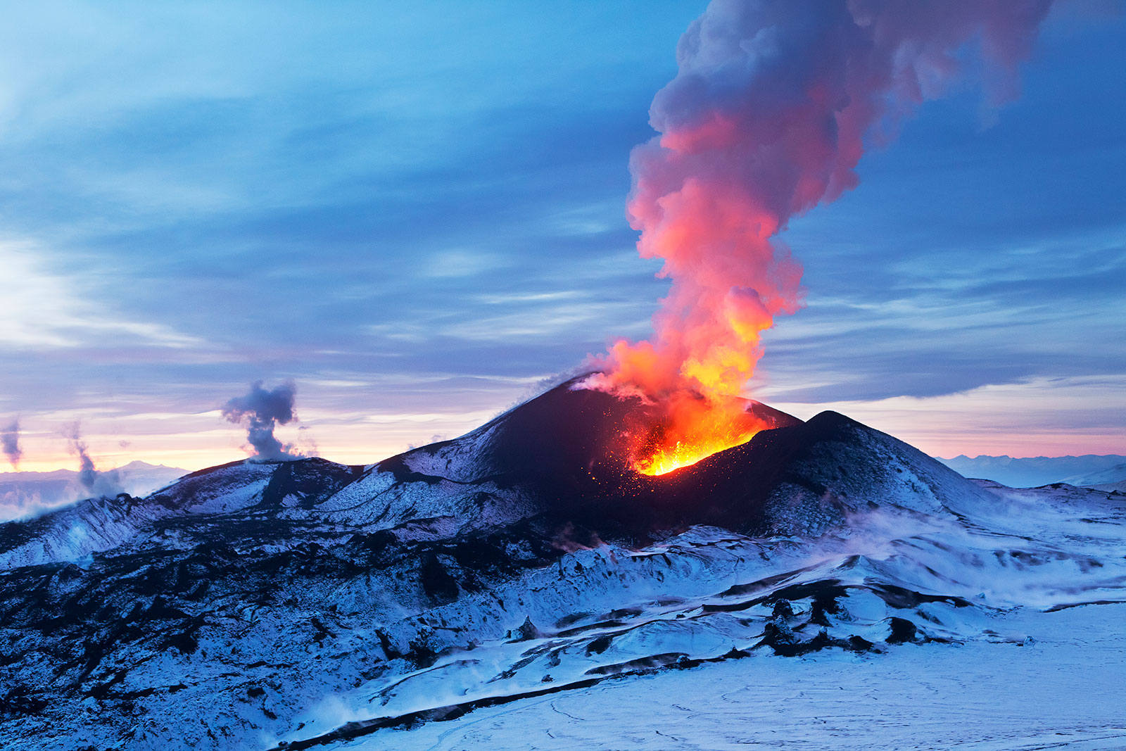
The world was rocked by several large volcanic eruptions in the past year, from the explosive activity of Mount Sinabung in Indonesia to the incredible lava flows of La Palma in the Canary Islands and Fagradalfjall in Iceland. Eruptions of all types display the incredible power of volcanoes and the unstoppable hazards they create. Volcanic ash particles called tephra ranging in size from tiny glass fragments to large boulders explode from these eruptions, harming people and destroying property. In this Monday’s Lesson, students explore environmental factors that influence where tephra falls.
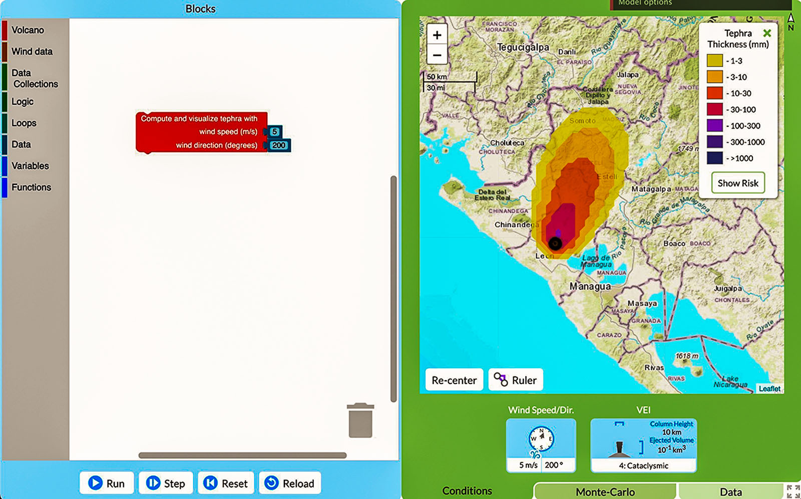
Our GeoCoder model allows students to experiment with both wind speed and direction to see how these factors affect the tephra distribution around a volcano. The model focuses on the Cerro Negro volcano in Nicaragua, an active cinder cone volcano that has erupted 10 times in the last 60 years. Using block code, students set values for wind speed and direction, which the simulation uses to produce a tephra distribution. The model output visualizes the area covered in tephra as well as the thickness of tephra on a map of the region around Cerro Negro.
1 Open the GeoCoder
Go to geocode-app.concord.org
In the Blocks menu on the left, go to the “Volcano” tab. Drag the block called “Compute and visualize tephra with wind speed (m/s) and wind direction (degrees)” into the program workspace. Click the “Data” tab and pull a number block into the slot next to wind speed. (They fit like puzzle pieces and lock into place.) Set the wind speed by clicking the number to change it to any value between 0 and 30 meters per second (or up to about 70 mph). Next, drag another number block and put it in the wind direction slot. Set the value between 0 and 360, which defines the direction the wind is blowing from. Finally, run the model.
2 Analyze the tephra distribution
After the code runs, a multicolored tephra distribution appears on the map as colors representing the thickness of tephra (Figure 1). (See the key in the upper right of the map.) Zoom in to see the towns and cities covered by tephra and use the ruler to measure how far the wind blew the tephra from the volcano.
3 Discover patterns
Reset the model, then change wind speed and/or wind direction to explore their effects on tephra distribution. How does the shape of the distribution change as wind speed increases? Which wind direction causes the most towns to be covered in tephra? To simulate multiple eruptions in a single run, stack two “Compute and visualize” blocks on top of each other with different inputs.
4 Dig deeper
To experiment with the size of the eruption, change the Volcanic Explosivity Index (VEI) value of eruptions (0-8) following the steps above to add a volcano block with VEI and number blocks. VEI accounts for column height and ejected volume, which affect the distribution of tephra.
5 Discuss
What are the impacts of tephra falling on people’s homes, cars, and their agricultural land? Only a few millimeters of tephra ash can devastate vegetation by covering leaves and preventing photosynthesis. Thicker tephra deposits (100-300 mm) can collapse roofs and limit ground and air transportation.
Looking for more?
Created by our GeoCode project, the GeoCoder has been embedded in a weeklong curriculum unit for middle and high school classes. Students explore tephra distributions and wind data to make risk assessments for the towns surrounding Cerro Negro.
Chris Lore (clore@concord.org) is a research assistant.
This material is based upon work supported by the National Science Foundation under grant DRL-1841928. Any opinions, findings, and conclusions or recommendations expressed in this material are those of the author(s) and do not necessarily reflect the views of the National Science Foundation.