Exploring the Spread of Wildfires and Interpreting Their Risks
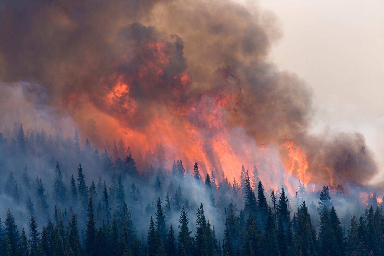
Turn on the news and you will likely hear about a natural hazard. Wildfires in California, flooding in the Midwest, hurricanes across the Atlantic Coast. Natural phenomena cause widespread damage and destruction, and lately they seem to be more frequent and severe. Faced with an imminent threat, however, there is precious little time to research occurrence or risk factors, or to develop a comprehensive plan of action. Indeed, there may be only days or even hours to make a decision: stay or evacuate? A more informed public with a better understanding of the science behind natural hazards can more effectively interpret the risks associated with the hazards and consider vulnerabilities that were previously overlooked.
The goal of the GeoHazard: Modeling Natural Hazards and Assessing Risks project is to integrate Earth systems models with easy-to-use data analysis tools. These tools allow students to evaluate natural hazards holistically, including the factors that influence their formation, progression, and severity, and that contribute the most to potential risks. The project focuses on three common natural hazards: hurricanes, wildfires, and floods.
Similar to geoscientists who have harnessed the power of new technologies to look at natural processes in unique ways, GeoHazard uses computer simulations to address these natural hazards in science classrooms. Earth is a set of complex systems and it is critical to observe the interactions among the subsystems.
Modeling of natural hazards like floods, wildfires, and hurricanes has advanced over the last 30 years, and geoscientists now have the ability to accurately predict the propagation and impacts of each hazard in thousands of different virtual scenarios. Every time a natural hazard occurs, scientists update and refine their models by including this new data. As models recalibrate with the new information, scientists gain a better understanding of the phenomena under study. By constantly collecting data and improving computational models, scientists not only understand the phenomenon better as a whole, but can also define the influence of each variable in the system more accurately. A critical development in the study of most natural hazards is that we now understand the system variables so well, it is no longer necessary to go into the field and observe them for ourselves in order to learn more. Instead, we can safely conduct experiments under different scenarios from the comfort of a computer lab. The study of natural hazards has shifted from a slow, dangerous, purely observational science to an efficient, safe, and investigative one.
Using sophisticated modeling technology, students also have the ability to examine causal mechanisms and investigate multiple factors simultaneously. Importantly, they can experiment with Earth systems in a holistic way in order to fully understand emergent properties like natural hazards and their effects on humans.
Wildfire Explorer
The GeoHazard project has developed a curriculum module and a simulation to help students investigate wildfires. When used together, they help form and elicit student ideas about the risks and hazards wildfires pose to people and communities in their path. Additionally, the scientific factors that affect the formation, propagation, and intensity of wildfires are used to explain when and why wildfires turn from a natural phenomenon to a natural hazard.
Wildfire Explorer merges calculations of wildfire spread with visualizations of fire expanding over landscapes similar to those in the Midwest and western United States. The equation used to calculate the behavior of a fire was developed by the U.S. Geological Survey and has been used for fire and vegetation management since 1972. Rothermel’s equation, as it is called, considers both environmental parameters such as wind speed, wind direction, and topography, as well as vegetation characteristics like size, depth, density, and volume. Students can experiment with five variables in the model to understand their effect on wildfire spread: terrain, drought levels, vegetation type, wind speed, and wind direction.
The visualization of Rothermel’s equation is a zoned landscape comprised of mountains, hills, or plains. Through the Terrain Setup window (Figure 1), students set values for each variable. The visualization updates as each parameter is set, showing unique colors for different drought levels, a compass rose depicting wind speed and direction, and other features such as towns and rivers. Finally, students place one or more sparks on the model to simulate an ignition point. As the fire spreads, the model displays the emergent behavior of wildfires. For example, students watch as fire shoots up the side of a mountain and at the same time see another fire progress evenly across a plain (Figure 2). This simultaneous, side-by-side comparison allows students to observe change over time and is essential to understanding how each variable influences spread.
In addition to learning about different factors that affect wildfire spread, questions in the curriculum prompt students to use what they know about spread to grapple with questions about risk and impacts. Risk assessment involves judging both the likely occurrence of an event and the likely damage caused by the event. In the case of natural hazards, not all people and locations are impacted in the same way. Is a town in the mountains in greater danger of wildfires than an apartment in the city? If a community is built around a river, does that mean it is impervious to burning?
Wildfire Explorer includes two types of fire fighting techniques, firelines and helitacks. Firelines are built by teams of firefighters in the real world and are simulated in the model by drawing a line across the land in an attempt to contain fire spread. Helitacks are used to douse swaths of vegetation by helicopter in the hope of making it too wet to burn. As the wildfire spreads in the model, students have to make quick decisions to understand which areas are the most at risk, and, therefore, where to use available resources to slow the fire down or protect those regions.


Finally, students use the model to answer the framing question of the curriculum: “How will wildfires change in the next 100 years?” Global climate change is altering everything from ecosystems to weather patterns, and wildfire behavior is influenced heavily by these changes. Using the model, students can represent both increased drought and changing vegetation caused by climate change. They are prompted to experiment with the ways these shifts affect the risks of wildfires. They are also encouraged to examine how mitigation efforts have to change in response to stronger or bigger fires, and to consider deeper, long-term changes society can make to reduce the risk of wildfire hazards.
As the adage goes, knowledge is power. The GeoHazard project aims to help students understand natural hazards as they develop scientific reasoning in the context of risk. In a world of increasingly frequent natural hazards, informed action is the best way to mitigate disasters.
Chris Lore (clore@concord.org) is a research assistant.

Photo credit: Michael Melford National Geographic Creative
This material is based upon work supported by the National Science Foundation under grant DRL-1812362. Any opinions, findings, and conclusions or recommendations expressed in this material are those of the author(s) and do not necessarily reflect the views of the National Science Foundation.