Monday’s Lesson: Finding Your Watershed
From filling reusable water bottles to taking showers, students use water all the time. But do they know where their water comes from? The Watershed Awareness Using Technology and Environmental Research for Sustainability (WATERS) curriculum helps middle school students explore the health of their local watershed, investigate the impact of humans on their watershed, and learn about water-related careers.
A watershed is a system defined by the area of land over which all water drains downhill through streams and rivers to a common outlet (river, lake, bay, or ocean). Water that runs over the land as runoff or in streams and rivers flows downhill, directed by the topography. A divide is a ridge of land where water flows in opposite directions and forms the boundary of a watershed. Each stream has a divide that separates the area of land that drains to that stream from other watersheds. As streams flow together, watersheds combine to form a larger land area that drains to a common river.
Model My Watershed
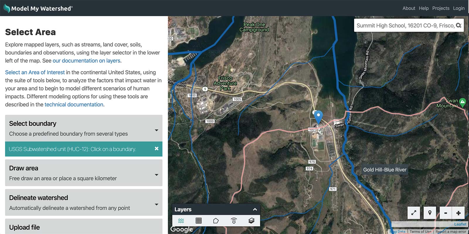
Model My Watershed® is a free web-based geographic information systems (GIS) app that includes U.S. Geological Survey (USGS), U.S. Department of Agriculture, and other scientific datasets for watershed modeling across the lower 48 states (Figure 1).
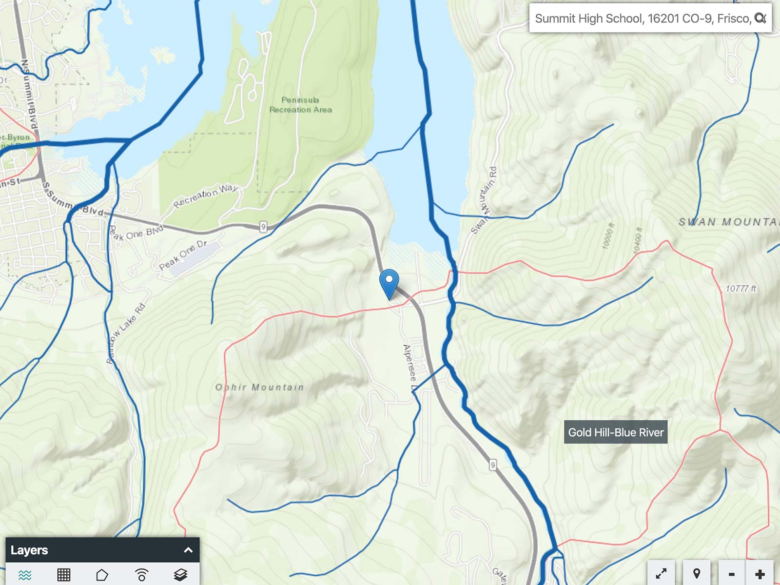
- Go to ModelMyWatershed.org. Enter your school’s address and press return on your keyboard.
- Click the “Basemaps” icon

 in the Layers box and select the different layers to explore the area around your school.
 - Identify the first body of water downhill from your school. This is your school’s primary watershed.
- Set the basemap to “Satellite with Roads” and click “Get started” in the left panel.
- Click the down arrow by “Select boundary” in the left panel and choose “USGS Subwatershed unit (HUC-12).” The USGS uses the hydrologic unit code (HUC) to classify the size of watersheds.
- Red lines appear on the map to outline local watersheds. Hover the cursor over your school to see the name of your watershed. (You may need to zoom out.)
- Click on your school property to see its subwatershed. Zoom and scroll to explore the map.
- To see how the subwatershed units combine to form larger watershed units, click “Change area” at the bottom of the Analyze panel, then “Select boundary” and choose “USGS Watershed unit (HUC-10).”
Ask students to reflect on:
- Where does water flow in a watershed?
- What is the closest body of water downhill from your school?
- If pollutants were added to the local watershed around your school, what other areas would be affected by the pollution?
To dive deeper, click “Delineate watershed” in the left panel, select “Continental US,” and click the map to mark a point of interest. The app determines the path that water flows downhill from this purple button to reach a body of water (blue button). It also outlines the total land area where water drains to that location (the primary watershed), and analyzes this area with data on streams, land cover, soil, and more. (Note: If the landscape is too flat, the app may not be able to draw the watershed.) Download the data for even further exploration. Model My Watershed offers multiple opportunities for investigation, so students can explore just like water scientists.
Carolyn Staudt (cstaudt@concord.org) is a senior scientist.
David Kline (dkline@stroudcenter.org) is a watershed educator at Stroud Water Research Center.
Joyce Massicotte (jmassicotte@concord.org) is a project manager.
This material is based upon work supported by the National Science Foundation under grant DRL-1417722. Any opinions, findings, and conclusions or recommendations expressed in this material are those of the author(s) and do not necessarily reflect the views of the National Science Foundation.