A Virtual Storm Teaches Computational Thinking
Few phenomena are as important to our daily lives as weather. We listen intently to reports of far-flung weather catastrophes and exchange updates about our local weather as a matter of course. Weather is no less important to children—a rained-out championship game or an unexpected snow day can be a major event.
Weather and weather forecasting offer an ideal medium for the integration of science, mathematics, and computational thinking. To predict the weather, meteorologists must understand data quality and sampling trade-offs, speak the language of computational models, and be able to clearly characterize the uncertainty of model predictions. It’s no wonder that understanding weather is found throughout the Next Generation Science Standards from kindergarten through high school.
Working with Argonne National Laboratory, Millersville University, and the University of Illinois at Chicago, we are designing and testing instructional materials and technologies to promote eighth grade students’ abilities to apply computational thinking practices and understandings in the context of weather and weather prediction. Funded by the National Science Foundation, the Integrating Meteorology, Mathematics, and Computational Thinking project (known as Precipitating Change) aims to empower students to understand and apply weather-related science and mathematics by employing computational thinking involving data and models.
An inquiry-based curriculum
The Precipitating Change curriculum targets two main NGSS standards: MS-ESS2-5 (Collect data to provide evidence for how the motions and complex interactions of air masses result in changes in weather conditions) and MS-ESS3-2 (Analyze and interpret data on natural hazards to forecast future catastrophic events and inform the development of technologies to mitigate their effects). Our curriculum design uses an “embedded phenomena” framework* in which scientific phenomena are scaled to classroom size and become shared objects of collaborative inquiry.
Over the course of six lessons, students have to decide whether an event can take place, based on their weather predictions. Their classroom is an imagined geographic region approximately 250 x 250 miles. Students take tablet-based mobile weather stations (Figure 1) to different “towns” distributed around the classroom to record local ground conditions (e.g., rainfall, temperature, wind speed, wind direction, and moisture content). The data is based on historical records of actual measured weather conditions, collected by Argonne National Laboratory and aggregated in large datasets.

The stage is set for students to act as a local planner who must decide whether an outdoor event (e.g., a popular fun run or a traditional Alaskan blanket toss) can occur as planned. Using the weather station dashboard, the teacher initiates a virtual storm and students experience the weather event passing through their classroom (Figure 2). In the first two lessons, students capture temperature, precipitation, and moisture data over a series of time stamps and record it for the gridded region of their classroom. The teacher then pauses the simulated event, while students try to predict what the weather will be four hours later. After the teacher restarts the simulation, students can check the accuracy of their forecast.
 showing the larger map of the region.")
Working in teams, students then transcribe the numerical readings from their weather stations onto gridded poster sheets representing successive points in time (Figure 3) to produce an aggregated history of the simulated phenomenon. Using colored sticky notes to represent temperature ranges, students create a more abstract representation that allows them to see emerging patterns (Figure 4). They estimate the values of “missing data” in areas that do not have weather stations using multiple interpolation methods (linear, nearest neighbor, and weighted average interpolation). The time series of maps produced in this way creates a visual storyline that allows students to extrapolate patterns and construct simple predictions of future weather conditions.

Classroom activities involve students in a broad range of activities—data aggregation and abstraction, pattern recognition, interpolation, and extrapolation—that are at the core of computational thinking and data analysis. Acting as an atmospheric scientist—collecting weather data from weather stations over a large area over time and organizing it into useful maps to predict weather—is an authentic and powerful way to immerse students in science.

In subsequent lessons students continue using computational thinking skills such as interpolation and extrapolation to determine where it rains. Students revisit the weather maps they constructed earlier and add precipitation and air moisture data for additional time stamps. Next, students are introduced to a NetLogo model that allows them to test rules with the dataset they have been exploring. For example, they program a condition, like wind speed or air moisture, and see the resulting effects on precipitation. Students then investigate the role of wind in determining the weather by exploring the patterns of air movement within and between air masses. Using a hands-on “wind table,” they study where the air comes from and how fronts move (Figure 5). In the final lesson students revisit the original question: Will the weather forecast force them to cancel the event?

Research
Our research focuses on how enacted experiences, including classroom embedded phenomena, experimentation with real-world phenomena, exploration via computer modeling and simulation, and the use of authentic data representations, lead to understanding science, mathematics, and computational thinking content, and which learning environment designs foster and scaffold these experiences effectively.
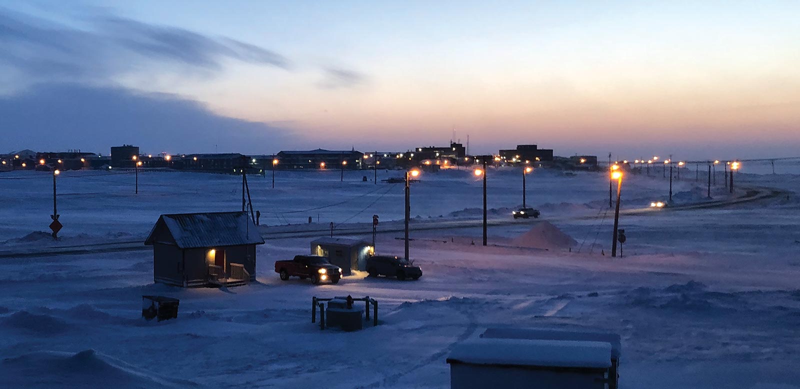
We have piloted the Precipitating Change curriculum in three classrooms in Massachusetts and one in the North Slope of Alaska (near one of Argonne National Laboratory’s three atmospheric research sites). Next year, we’ll extend investigations to additional classrooms in two Native Alaskan villages to explore curricular changes that ensure maximum generalization and usability across classrooms through additional scaffolding and Universal Design for Learning affordances for English Language Learners. Our goal is to bring more weather talk informed by computational thinking skills and practices to more places—because everyone wants to know the answer to “What’s the forecast?”
Carolyn Staudt (cstaudt@concord.org) is a senior scientist.
Tom Moher (moher@uic.edu) is an Emeritus Associate Professor, University of Illinois at Chicago.
Joyce Massicotte (jmassicotte@concord.org) is a project manager.
This material is based upon work supported by the National Science Foundation under grant DRL-1640088. Any opinions, findings, and conclusions or recommendations expressed in this material are those of the author(s) and do not necessarily reflect the views of the National Science Foundation.